MyTopo
Minersville Pennsylvania US Topo Map
Couldn't load pickup availability
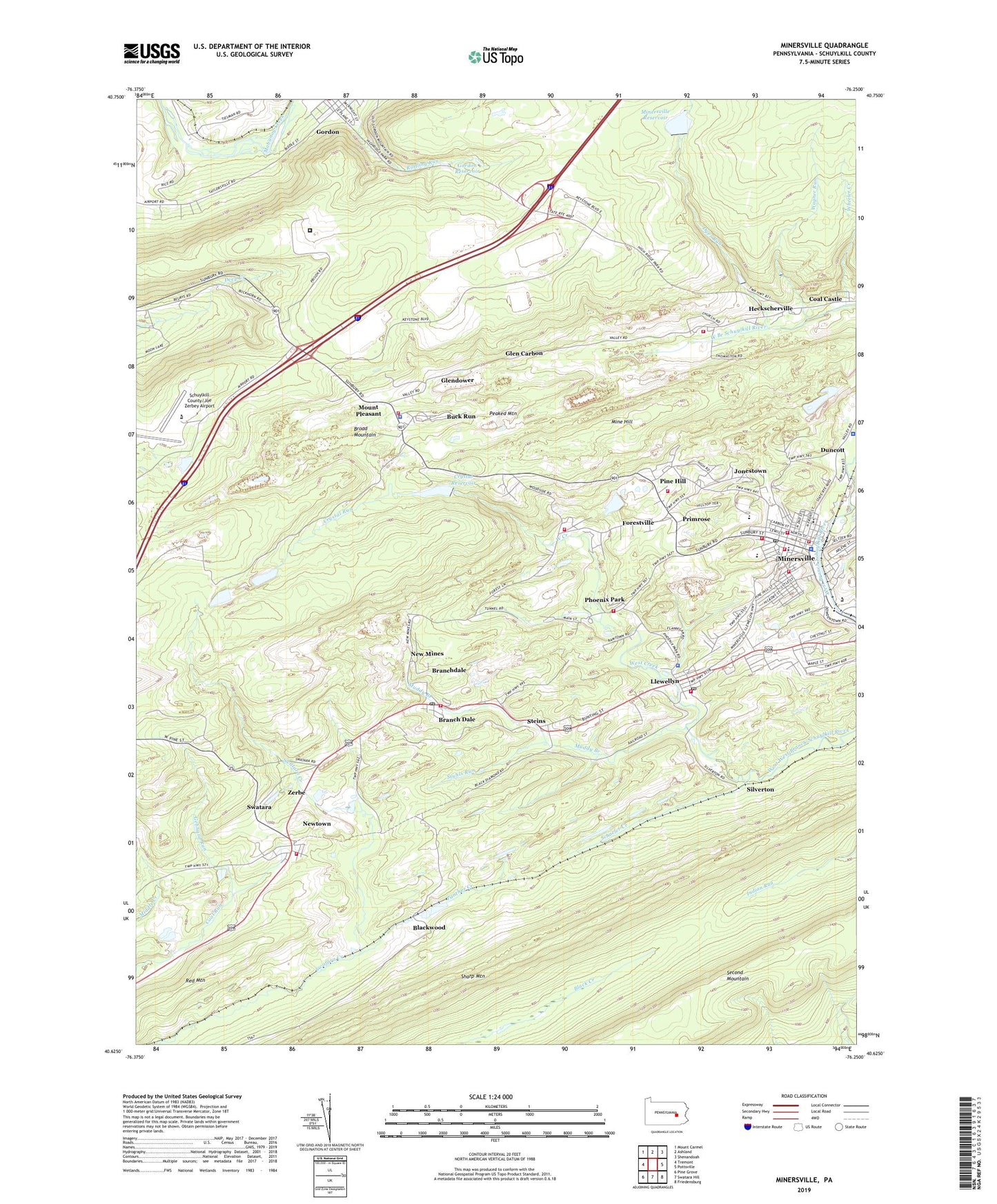
2023 topographic map quadrangle Minersville in the state of Pennsylvania. Scale: 1:24000. Based on the newly updated USGS 7.5' US Topo map series, this map is in the following counties: Schuylkill. The map contains contour data, water features, and other items you are used to seeing on USGS maps, but also has updated roads and other features. This is the next generation of topographic maps. Printed on high-quality waterproof paper with UV fade-resistant inks.
Quads adjacent to this one:
West: Tremont
Northwest: Mount Carmel
North: Ashland
Northeast: Shenandoah
East: Pottsville
Southeast: Friedensburg
South: Swatara Hill
Southwest: Pine Grove
This map covers the same area as the classic USGS quad with code o40076f3.
Contains the following named places: Blackwood, Borough of Minersville, Branch Dale, Branch Township Police Department, Branchdale Census Designated Place, Branchdale Post Office, Buck Run, Buck Run Census Designated Place, Cass Township Police Department, Citizens Fire Company Branchdale District 24 Station 1, Clover Fire Company District 5 Station 3, Crystal Dam, Crystal Reservoir, Crystal Run, Dyer Run, Dyers Run Dam Number Three, Federal Correctional Institution Schuykill, Forestville, Forestville Census Designated Place, Forestville Citizens Fire Company District 5 Station 2, Foster Township Police Department, Gebhard Run, Glen Carbon, Glendower, Good Intent Hose Company District 3 Station 1, Goodwill Fire Company District 51 Station 1, Gordon Reservoir, Heckscherville, Heckscherville Census Designated Place, Jonestown, Llewellyn, Llewellyn Post Office, Middle Creek, Mine Hill, Minersville, Minersville Dam Number Four, Minersville Fire Department - Fire and Rescue District 51 Station 2, Minersville Fire Department - Fire and Rescue Station 2, Minersville Police Department, Minersville Post Office, Minersville Reservoir, Mount Pleasant, Mount Pleasant Hose Company District 11 Station 1, Mountaineer Hose Company District 51 Station 3, Muddy Branch, New Minersville Fire Company District 51 Station 4, New Mines, Newtown, Newtown Census Designated Place, Newtown Volunteer Fire Company District 24 Station 2, Number One Dam, Number Three Dam, Number Two Dam, Panther Creek, Peaked Mountain, Phoenix Park, Phoenix Park Community Fire Company District 3 Station 2, Pine Hill, Primrose, Schaefer Creek, Schuylkill County/Joe Zerbey Airport, Sharp Mountain, Silverton, South Cass Citizens Fire Company District 5 Station 4, State Game Lands Number 229, Steins, Stuhls Run, Swatara, Township of Branch, Township of Cass, Township of Foster, Township of Reilly, Triedens Church, Wagner Run, West Creek, Wheeler Creek, Zerbe, ZIP Codes: 17901, 17923, 17944, 17954