MyTopo
Red Rock Pennsylvania US Topo Map
Couldn't load pickup availability
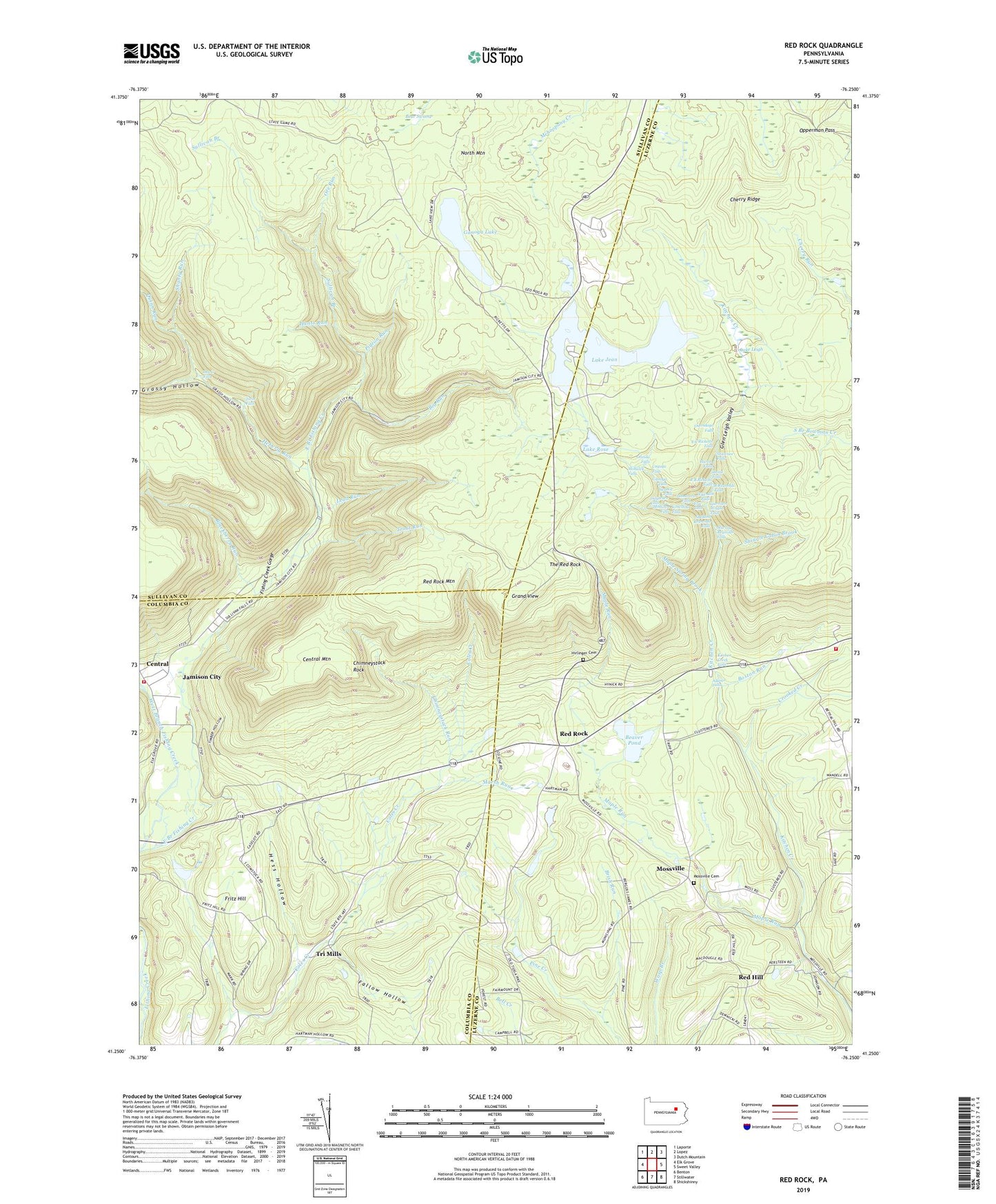
2023 topographic map quadrangle Red Rock in the state of Pennsylvania. Scale: 1:24000. Based on the newly updated USGS 7.5' US Topo map series, this map is in the following counties: Luzerne, Sullivan, Columbia. The map contains contour data, water features, and other items you are used to seeing on USGS maps, but also has updated roads and other features. This is the next generation of topographic maps. Printed on high-quality waterproof paper with UV fade-resistant inks.
Quads adjacent to this one:
West: Elk Grove
Northwest: Laporte
North: Lopez
Northeast: Dutch Mountain
East: Sweet Valley
Southeast: Shickshinny
South: Stillwater
Southwest: Benton
This map covers the same area as the classic USGS quad with code o41076c3.
Contains the following named places: Adams Falls, Ashelman Run, B Reynolds Falls, Bear Swamp, Beaver Pond, Benton Air Force Station, Big Run, Blackberry Run, Boston Run, Boston Run Nature Area, Brish Run, Cayuga Falls, Central, Central Mountain, Cherry Ridge, Chimneystack Rock, Chimneystack Run, Conestoga Falls, Crooked Creek, Delaware Falls, East Branch Fishing Creek, Erie Falls, F L Ricketts Falls, Fairmount Springs, Fairmount Township Volunteer Fire Department Station 131, Fallow Hollow, Fishing Creek Gorge, Fritz Hill, Ganoga Falls, Ganoga Glen, Ganoga Lake, Glen Leigh, Glen Leigh Valley, Grand View, Grand View Fire Tower, Grassy Hollow, Harrison Wright Falls, Heberly Run, Hess Hollow, Hirlinger Cemetery, Hunts Run, Huron Falls, Jamison City, Jamison City Census Designated Place, Kitchen Creek Falls, Kitchen Creek Gorge, Lake Jean, Lake Jean Dam, Lake Leigh, Lake Rose, Lead Run, Lewis Falls, Maple Run, Maple Spring Brook, Marsh Run, Midway Crevasse, Mohawk Falls, Mohican Falls, Mossville, Mossville Cemetery, Murray Reynolds Falls, North Mountain Volunteer Fire Company Station 260, Old Bulldozer Road Trail, Oneida Falls, Onondaga Falls, Opperman Pass, Ore Run, Ozone Falls, Pigeon Run, Quinn Run, R B Ricketts Falls, Red Hill, Red Rock, Red Rock Mountain, Ricketts Glen, Ricketts Glen State Park, Seneca Falls, Shanty Run, Shawnee Falls, Sheldon Reynolds Falls, Shingle Cabin Brook, Sugarloaf Community Rescue and Ambulance, Sullivan Branch, The Glens, The Red Rock, Township of Fairmount, Township of Sugarloaf, Tri Mills, Trout Run, Tuscarora Falls, Twin Falls, West Branch Fishing Creek, Wyandot Falls, ZIP Code: 17814