MyTopo
Elk Grove Pennsylvania US Topo Map
Couldn't load pickup availability
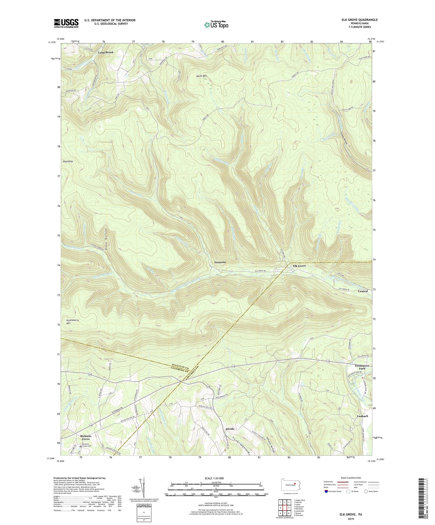
2023 topographic map quadrangle Elk Grove in the state of Pennsylvania. Scale: 1:24000. Based on the newly updated USGS 7.5' US Topo map series, this map is in the following counties: Sullivan, Columbia, Lycoming. The map contains contour data, water features, and other items you are used to seeing on USGS maps, but also has updated roads and other features. This is the next generation of topographic maps. Printed on high-quality waterproof paper with UV fade-resistant inks.
Quads adjacent to this one:
West: Sonestown
Northwest: Eagles Mere
North: Laporte
Northeast: Lopez
East: Red Rock
Southeast: Stillwater
South: Benton
Southwest: Lairdsville
This map covers the same area as the classic USGS quad with code o41076c4.
Contains the following named places: Bearwallow Run, Big Run, Bloody Run, Brandon Church, Cherry Grove Church, Cherry Run, Deep Hollow, Divide, Elk Grove, Elk Run, Emmons, Fritz Camp, Gallows Run, Grassmere Park, Hog Run, Huckleberry Mountain, Laubach, Laurel Run, Long Brook, Long Run, Meeker Run, Oxhorn Run, Painter Run, Peterman Run, Richarts Grove, Richarts Grove Cemetery, Rough Run, Roundtop, Shingle Mill Run, Sugarloaf School, Township of Davidson