MyTopo
Strongstown Pennsylvania US Topo Map
Couldn't load pickup availability
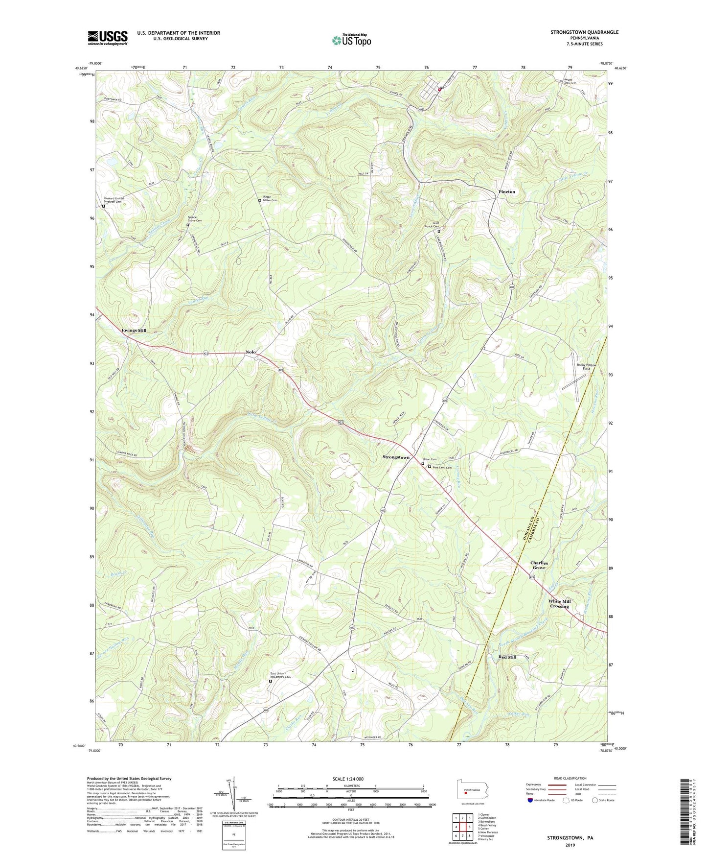
2023 topographic map quadrangle Strongstown in the state of Pennsylvania. Scale: 1:24000. Based on the newly updated USGS 7.5' US Topo map series, this map is in the following counties: Indiana, Cambria. The map contains contour data, water features, and other items you are used to seeing on USGS maps, but also has updated roads and other features. This is the next generation of topographic maps. Printed on high-quality waterproof paper with UV fade-resistant inks.
Quads adjacent to this one:
West: Brush Valley
Northwest: Clymer
North: Commodore
Northeast: Barnesboro
East: Colver
Southeast: Nanty Glo
South: Vintondale
Southwest: New Florence
This map covers the same area as the classic USGS quad with code o40078e8.
Contains the following named places: Adams Crossing, Apollo 2 Mine Station, Barkley Church, Belsano Camp, Blaides, Carney Run, Charlies Grove, Croft, Downey Run, Dunkard United Brethren Cemetery, East Union - McCartney Cemetery, East Union Church, Elk Creek, Ewings Mill, Faith Temple, Heilwood, Heilwood Census Designated Place, Heilwood Post Office, Laurel Run, Leonard Run, Maple Grove Cemetery, Maple Grove Church, Mount Zion Cemetery, Nolo, Pine Land Cemetery, Pine Township Volunteer Fire Department Station 570, Pineton, Red Mill, Rocky Hollow Field, Rose Run, Saint Patrick Cemetery, Saint Patricks Church, Simmons Run, Spruce Grove Cemetery, Spruce Grove Church, Stevens Run, Strongstown, Township of Buffington, Township of Pine, Union Cemetery, Walker Run, White Mill Crossing, ZIP Codes: 15745, 15765, 15922, 15957