MyTopo
Commodore Pennsylvania US Topo Map
Couldn't load pickup availability
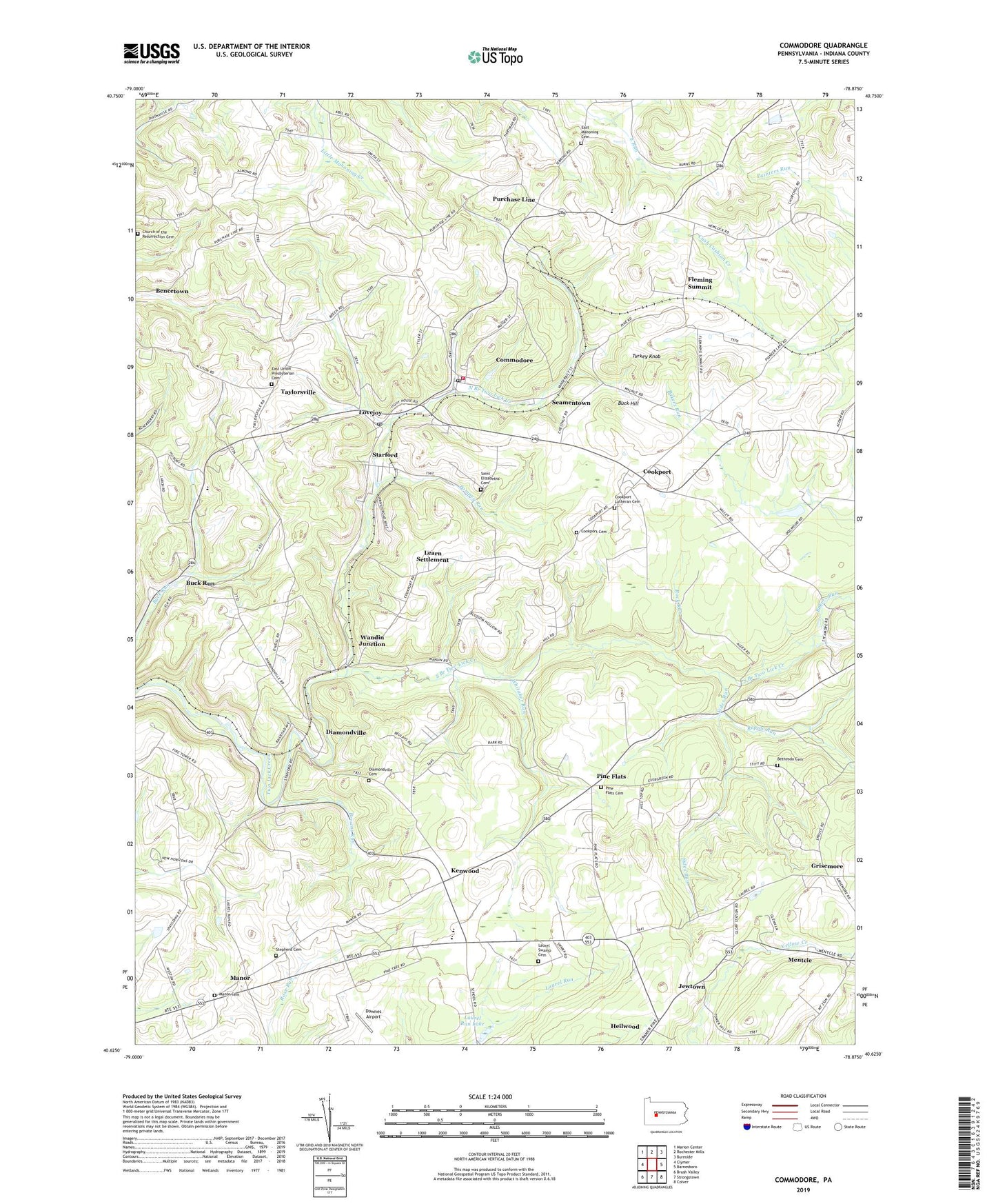
2023 topographic map quadrangle Commodore in the state of Pennsylvania. Scale: 1:24000. Based on the newly updated USGS 7.5' US Topo map series, this map is in the following counties: Indiana. The map contains contour data, water features, and other items you are used to seeing on USGS maps, but also has updated roads and other features. This is the next generation of topographic maps. Printed on high-quality waterproof paper with UV fade-resistant inks.
Quads adjacent to this one:
West: Clymer
Northwest: Marion Center
North: Rochester Mills
Northeast: Burnside
East: Barnesboro
Southeast: Colver
South: Strongstown
Southwest: Brush Valley
This map covers the same area as the classic USGS quad with code o40078f8.
Contains the following named places: Bakers Run, Bencetown, Bethesda Cemetery, Browns Run, Buck Hill, Buck Run, Calvary Church, Church of the Resurrection Cemetery, Citizens Ambulance Service Hillsdale Station 40, Clymer Fire Tower, Commodore, Commodore Census Designated Place, Commodore Post Office, Commodore Volunteer Fire Department Station 540, Cookport, Cookport Cemetery, Cookport Lutheran Cemetery, Davis Dam, Diamondville, Diamondville Cemetery, Downes Airport, East Mahoning Cemetery, East Mahoning Church, East Union Presbyterian Cemetery, Fleming Summit, Glenside Mine Station, Grisemore, Jewtown, Kenwood, Laurel Run Lake, Laurel Swamp Cemetery, Laurel Swamp Union Church, Leard, Learn Settlement, Lovejoy, Manor, Manor Cemetery, Manver, Manver Station, Mentcle, Mitchell Mills, North Branch Two Lick Creek, Penns Manor Church, Penns Manor High School, Pine Flats, Pine Flats Cemetery, Pompey Run, Prosperity Hill, Purchace Line South Elementary School, Purchase Line, Purchase Line High School, Repine Run, Rock Run, Saint Elizabeths Cemetery, Seamentown, Sharkstown, Sides Run, South Branch Two Lick Creek, Standford Post Office, Starford, Starford Post Office, Stephens Cemetery, Taylorsville, Township of Green, Turkey Knob, Utah, Wandin, Wandin Junction, Whitaker Run, ZIP Codes: 15728, 15729, 15761, 15777