MyTopo
Elderton Pennsylvania US Topo Map
Couldn't load pickup availability
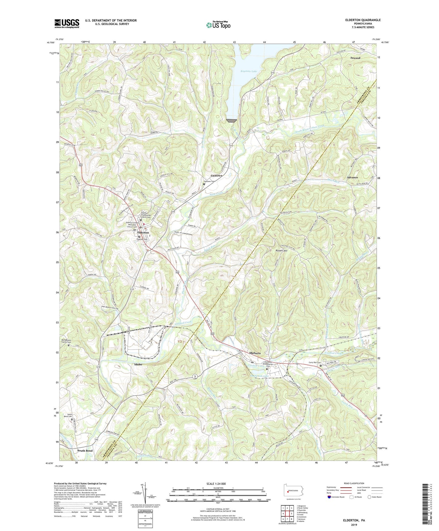
2019 topographic map quadrangle Elderton in the state of Pennsylvania. Scale: 1:24000. Based on the newly updated USGS 7.5' US Topo map series, this map is in the following counties: Armstrong, Indiana. The map contains contour data, water features, and other items you are used to seeing on USGS maps, but also has updated roads and other features. This is the next generation of topographic maps. Printed on high-quality waterproof paper with UV fade-resistant inks.
Quads adjacent to this one:
West: Whitesburg
Northwest: Mosgrove
North: Rural Valley
Northeast: Plumville
East: Ernest
Southeast: Indiana
South: McIntyre
Southwest: Avonmore
Contains the following named places: Advance, Anthony Run, Borough of Elderton, Borough of Shelocta, Cessna Run, Cheese Run, Citizens Ambulance Service Elderton Station 81, Curry Run, Curry Run Cemetery, Curry Run Church, Dark Hollow Run, Dutch Run, Elderton, Elderton Borough Police Department, Elderton Cemetery, Elderton District Volunteer Fire Company Station 50, Elderton Elementary School, Elderton High School, Elderton Post Office, Elderton Presbyterian Church Cemetery, Elderton United Methodist Church Cemetery, Fishers Siding, Flying O Airport, Gastown, Gastown Cemetery, Gobblers Run, Idaho, Keystone Station Dam, Miller, Mitchell Run, Montgomery Family Cemetery, North Branch Plum Creek, Plum Creek, Russell Hill, Saint Jacobs Church, Saint Thomas Church, Salem Church, Sample Reservoir, Sample Run Dam, Shady Side Lake, Sharon Oil and Gas Field, Shelocta, Shelocta Post Office, Shelocta Presbyterian Cemetery, Shelocta Station, South Bend, South Bend Cemetery, South Branch Plum Creek, Township of Armstrong, Township of Plumcreek, Walker Run, ZIP Codes: 15736, 15774