MyTopo
Whitesburg Pennsylvania US Topo Map
Couldn't load pickup availability
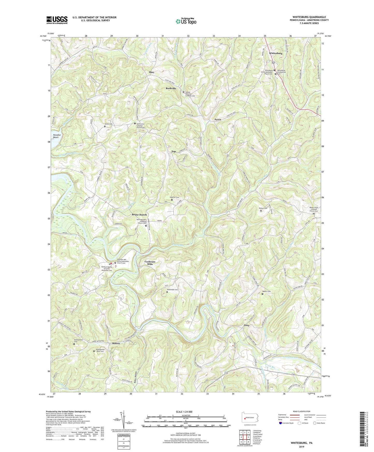
2023 topographic map quadrangle Whitesburg in the state of Pennsylvania. Scale: 1:24000. Based on the newly updated USGS 7.5' US Topo map series, this map is in the following counties: Armstrong. The map contains contour data, water features, and other items you are used to seeing on USGS maps, but also has updated roads and other features. This is the next generation of topographic maps. Printed on high-quality waterproof paper with UV fade-resistant inks.
Quads adjacent to this one:
West: Leechburg
Northwest: Kittanning
North: Mosgrove
Northeast: Rural Valley
East: Elderton
Southeast: McIntyre
South: Avonmore
Southwest: Vandergrift
This map covers the same area as the classic USGS quad with code o40079f4.
Contains the following named places: Baker Hollow, Brick Church, Burrell Township Volunteer Fire Department Station 290, Cherry Run, Cochrans Mill United Methodist Church Cemetery, Cochrans Mills, Cochrans Mills Church, Craig Run, Crooked Creek Lake, Crooked Creek Lake Recreation Area, Dunkard Baptist Christian Bretheren Cemetery, Elbow Run, Fagley Run, Girty, Horney Camp Run, Lindsay Run, Long Run, Mateer, McDonalds Cemetery, Mount Union Lutheran Church Cemetery, North Branch Cherry Run, Paradise Beach, Pine Run, Pyrra, Rockville, Rowley Cemetery, Rupert Cemetery, Saint Johns Church, Saint Johns Lutheran Church Cemetery, Saint Mathews Church, Saint Michaels Church, Saint Michaels Lutheran Church Cemetery, Shaeffer Cemetery, Shay, Shellhammer - Beck Cemetery, Shellhammer Cemetery, Shotts Cemetery, Sugar Run, Top, Township of Burrell, Township of South Bend, United Rockville Lutheran Cemetery, Whitesburg, Whitesburg Presbyterian Cemetery, Whitesburg United Methodist Church Cemetery, ZIP Code: 16226