MyTopo
Emporium Pennsylvania US Topo Map
Couldn't load pickup availability
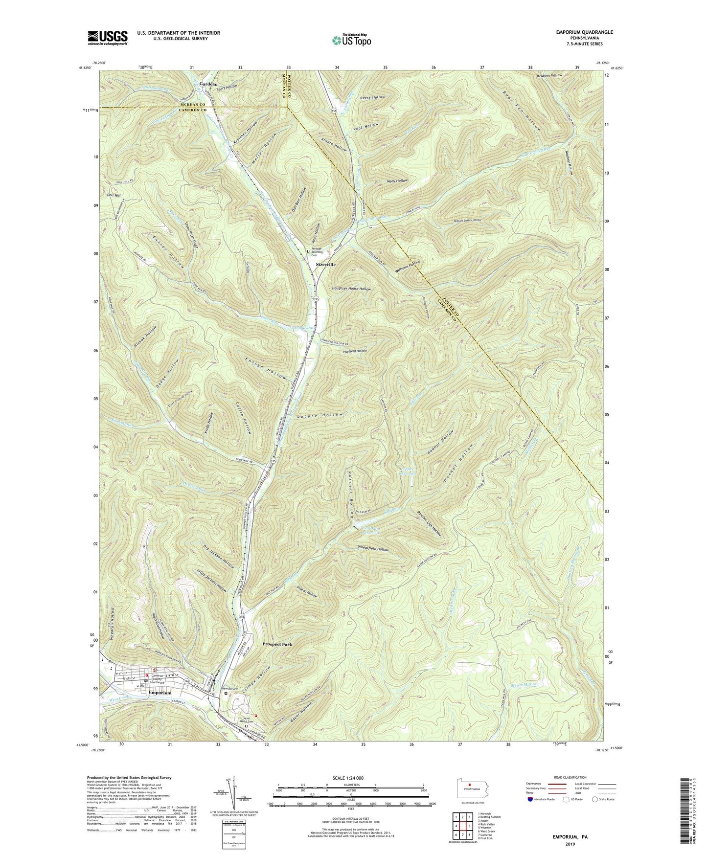
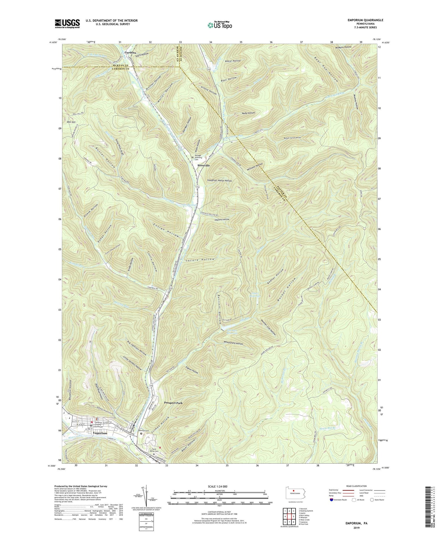
2019 topographic map quadrangle Emporium in the state of Pennsylvania. Scale: 1:24000. Based on the newly updated USGS 7.5' US Topo map series, this map is in the following counties: Cameron, Potter, McKean. The map contains contour data, water features, and other items you are used to seeing on USGS maps, but also has updated roads and other features. This is the next generation of topographic maps. Printed on high-quality waterproof paper with UV fade-resistant inks.
Quads adjacent to this one:
West: Rich Valley
Northwest: Norwich
North: Keating Summit
Northeast: Austin
East: Wharton
Southeast: First Fork
South: Cameron
Southwest: West Creek
Contains the following named places: Ames Hollow, Arnold Hollow, Bear Pen Hollow, Big Jackson Hollow, Borough of Emporium, Bucher Hollow, Bucktail Path, Buffalo Switch Hollow, Buffalo Switch Trail, Butler Hollow, Cameron County Ambulance Service Station 720, Cameron County Sheriff's Office, Catlin Hollow, Chicago Springs Trail, Climax Hollow, Cowley Run, Dan Barr Hollow, Department of Conservation and Natural Resources Elk District 13, Dodge Hollow, Doll Hill, Downey Run, East Branch Cowley Run, Emporium, Emporium Fire Department Station 14, Emporium Junction, Emporium Post Office, Ensign Hollow, Ensign Run, Fee Run, Fourmile Run, Gardeau, Hackett Trail, Hayfield Hollow, Hickok Hollow, Hunting Shanty Branch, Keystone Park Airport, Kimball Run, Krebs Hollow, Kreitner Hollow, Lake Bucktail, Little Jackson Hollow, Lucore Hollow, Mackey Hollow, Mackey Trail, McDowell Trail, McMann Hollow, McNuff Branch, McNuff Trail, Moore Draft, Mowray Trail, Nady Hollow, Newton Cemetery, North Branch Indian Run, Panther Lick Hollow, Parker Run, Pigeon Hollow, Pine Camp Trail, Plank Road Hollow, Porcupine Hollow, Portage Township Cemetery, Prospect Park, Prospect Park Census Designated Place, Rednor Hollow, Reese Hollow, Root Hollow, Russell Hollow, Saint Marks Cemetery, Salt Run, Salt Run Reservoir, Salt Run Reservoir Dam, Sears Hollow, Shippen Station, Sinnemahoning Portage Creek, Sizer Run, Sizerville, Sizerville Park, Sizerville Park Dam, Sizerville State Park, Slaughter House Hollow, South Branch Indian Run, Stone Chimney Hollow, Stony Pitch Draft, Switchback Trail, Township of Portage, Upper Reservoir, Weller Hollow, West Branch Cowley Run, West Creek, Wheatfield Hollow, Wheaton Hollow, Wiley Trail, Williams Hollow, WLEM-AM (Emporium)