MyTopo
Garards Fort Pennsylvania US Topo Map
Couldn't load pickup availability
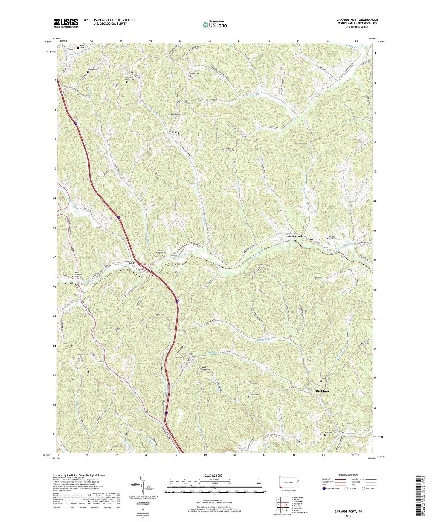
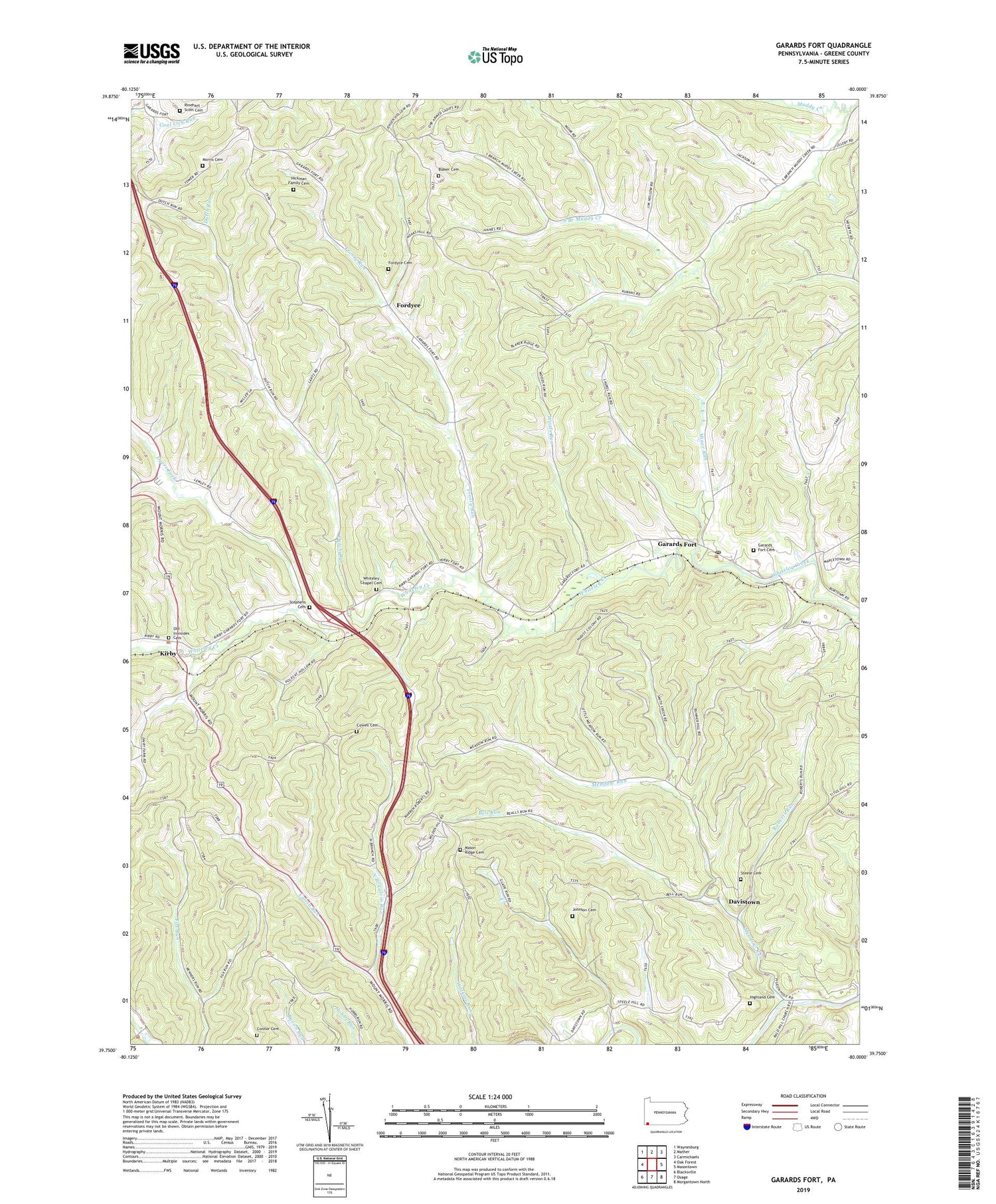
2019 topographic map quadrangle Garards Fort in the state of Pennsylvania. Scale: 1:24000. Based on the newly updated USGS 7.5' US Topo map series, this map is in the following counties: Greene. The map contains contour data, water features, and other items you are used to seeing on USGS maps, but also has updated roads and other features. This is the next generation of topographic maps. Printed on high-quality waterproof paper with UV fade-resistant inks.
Quads adjacent to this one:
West: Oak Forest
Northwest: Waynesburg
North: Mather
Northeast: Carmichaels
East: Masontown
Southeast: Morgantown North
South: Osage
Southwest: Blacksville
Contains the following named places: Asbury Church, Bell Run, Blaker Cemetery, Bowlby Shaft, Connor Cemetery, Cowell Cemetery, Davistown, Dutch Run, Dyers Fork, Fordyce, Fordyce Cemetery, Frosty Run, Frosty Run Shaft, Garards Fort, Garards Fort Cemetery, Garards Fort Post Office, Garards Fort Shaft, Glade Run, Hickman Family Cemetery, Highland Cemetery, Johnson Cemetery, Kirby, Kirby Shaft, Long Shaft, Mason Ridge Cemetery, Meadow Run, Minor Run, Morris Cemetery, North Branch Calvin Run, Old Ironsides Cemetery, Rinehart - Scott Cemetery, Roberts Run, State Game Lands Number 223, Steele Cemetery, Stephens Cemetery, Township of Greene, Township of Perry, Whiteley Chapel Cemetery, Woods Run, ZIP Codes: 15338, 15349