MyTopo
Tower City Pennsylvania US Topo Map
Couldn't load pickup availability
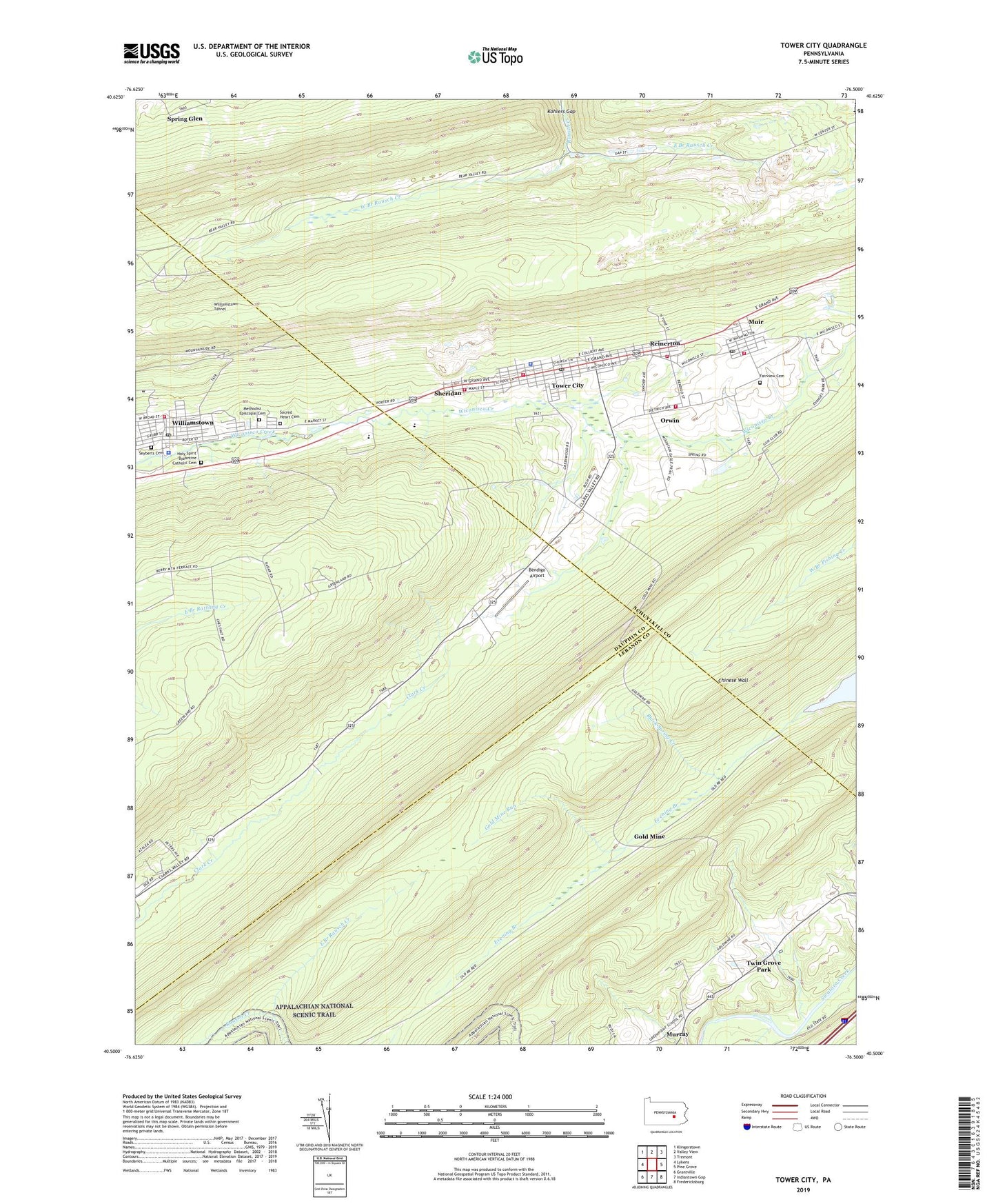
2023 topographic map quadrangle Tower City in the state of Pennsylvania. Scale: 1:24000. Based on the newly updated USGS 7.5' US Topo map series, this map is in the following counties: Schuylkill, Dauphin, Lebanon. The map contains contour data, water features, and other items you are used to seeing on USGS maps, but also has updated roads and other features. This is the next generation of topographic maps. Printed on high-quality waterproof paper with UV fade-resistant inks.
Quads adjacent to this one:
West: Lykens
Northwest: Klingerstown
North: Valley View
Northeast: Tremont
East: Pine Grove
Southeast: Fredericksburg
South: Indiantown Gap
Southwest: Grantville
This map covers the same area as the classic USGS quad with code o40076e5.
Contains the following named places: Bear Mountain, Bendigo Airport, Big Lick Mountain, Black Spring Creek, Borough of Tower City, Borough of Williamstown, Brookside, Chinese Wall, East Branch Rausch Creek, Evening Branch, Fairview Cemetery, Gold Mine, Gold Mine Run, Gold Mine Speedway, Greenfield, Holy Spirit Byzantine Catholic Cemetery, Kohlers Gap, Liberty Hose Company Station 24, Methodist Episcopal Cemetery, Muir, Muir Census Designated Place, Muir Post Office, Muir Volunteer Fire Company District 22 Station 1, Orwin, Orwin Census Designated Place, Orwin Fire Company District 22 Station 2, Pilgrim Church, Ravine Omni Tower, Reinerton, Reinerton Census Designated Place, Reinerton Volunteer Fire Company District 22 Station 3, Reinerton-Orwin-Muir Census Designated Place, Sacred Heart Cemetery, Saint Marks Church, Second Mountain, Seyberts Cemetery, Sheridan, Tallman Supply Company Airport, Tower City, Tower City - Porter Community Ambulance Service, Tower City Police Department, Tower City Post Office, Tower City Volunteer Fire Company District 66 Station 1, Township of Cold Spring, Township of Porter, Twin Grove Park, Union Church, Verizon Wireless Communications Tower, West Branch Rausch Creek, West End Fire Company Dstrict 22 Station 5, Williams Valley High School, Williams Valley Junction, Williamstown, Williamstown Area Emergency Medical Service Station 24, Williamstown Borough Police Department, Williamstown Post Office, Williamstown Tunnel, ZIP Code: 17957