MyTopo
Hammersley Fork Pennsylvania US Topo Map
Couldn't load pickup availability
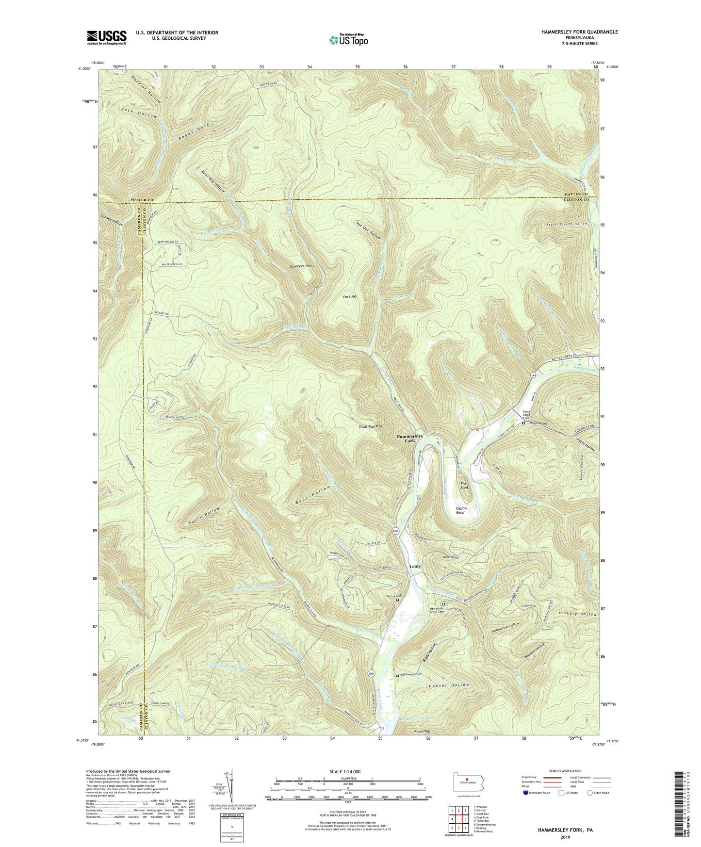
2019 topographic map quadrangle Hammersley Fork in the state of Pennsylvania. Scale: 1:24000. Based on the newly updated USGS 7.5' US Topo map series, this map is in the following counties: Clinton, Potter, Cameron. The map contains contour data, water features, and other items you are used to seeing on USGS maps, but also has updated roads and other features. This is the next generation of topographic maps. Printed on high-quality waterproof paper with UV fade-resistant inks.
Quads adjacent to this one:
West: First Fork
Northwest: Wharton
North: Conrad
Northeast: Short Run
East: Tamarack
Southeast: Renovo West
South: Keating
Southwest: Sinnemahoning
Contains the following named places: Austin Hollow, Baldy Hollow, Bear Hollow, Bear Trail, Bearfield Run, Beaverdam Run, Beech Bottom Hollow, Beech Bottom Natural Area, Beer Keg Hollow, Bell Branch, Bell Branch Trail, Boweyes Point, Bruner Branch, Calhoun Branch, Central School, Chicken Farm Trail, Cooney Hollow, County Line Run, County Line Trail, Daugherty Run, Fork Hill, Fork Hill Trail, Gospel Camp Cemetery, Gospel Camp Church, Greene Branch, Hammersley Fork, Hevner Run, Hickory Hollow, Hoover Hollow, Indian Camp Run, John Summerson Branch, Kates Hollow, Kettle Creek State Park, Leeds Hollow, Left Branch Lushbaugh Run, Left Branch Trail, Left Fork Bearfield Run, Left Fork Beaverdam Run, Left Fork Green Branch, Left Fork Hevner Run, Leidy, Lock Branch, Long Hollow, McCoy Cemetery, McCoy Run, Nelson Branch, New Maple Grove Cemetery, Oxbow Bend, Page Run, Parker Hollow Trail, Poges Hole, Right Branch Lushbaugh Run, Right Fork Bearfield Run, Right Fork Beaverdam Run, Right Fork Green Branch, Road Hollow, Spicewood Run, Stump Hollow, Summerson Cemetery, Summerson Hollow, Tate Hollow, The Bunk, Trout Run, Trout Run Mountain, Trout Run Ridge Trail, Upper Doctor Green Trail, Van Oak Hollow, Walters Run, Walters Run Trail, Weed Run, Wheaton Hollow, Wheeler Hollow, Wykoff Branch