MyTopo
Harford Pennsylvania US Topo Map
Couldn't load pickup availability
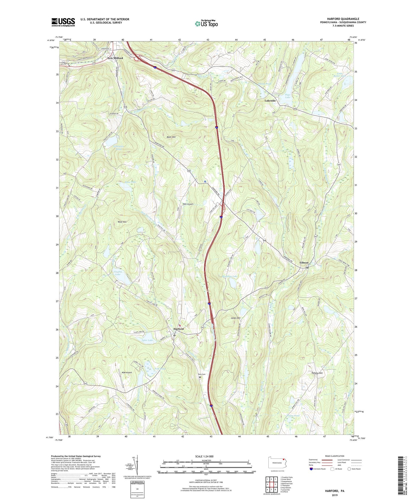
2019 topographic map quadrangle Harford in the state of Pennsylvania. Scale: 1:24000. Based on the newly updated USGS 7.5' US Topo map series, this map is in the following counties: Susquehanna. The map contains contour data, water features, and other items you are used to seeing on USGS maps, but also has updated roads and other features. This is the next generation of topographic maps. Printed on high-quality waterproof paper with UV fade-resistant inks.
Quads adjacent to this one:
West: Montrose East
Northwest: Franklin Forks
North: Great Bend
Northeast: Susquehanna
East: Thompson
Southeast: Clifford
South: Lenoxville
Southwest: Hop Bottom
Contains the following named places: Blanding Lake, East Lake Creek, Fenstermachers, Gibson, Gibson Post Office, Gillespies Pond, Grove School, Harford, Harford Post Office, Harford Volunteer Fire Company, Hunt Lake, Jones Hill, Kentuck Corners, Lakeside, Leslie Creek, Little Butler Creek, Little Butler Lake, Magnetic Laboratories Airport, Mott Hill, Moxley Corners, MSM Airport, New Milford, New Milford Post Office, Old Mill Village, Pa-467 Dam, Pa-467 Reservoir, Page Lake, Page Lake Dam, Payne Pond, Peck Cemetery, Peckins Airport, Pennsylvania State Police Troop R Gibson Station, Polk Pond, Purdy Dam, Steinbachs Corners, Stump Pond, Summit, Sweet Chapel, Tiffany Hill, Tingley Lake, Tingley Lake Dam, Township of Harford, Township of New Milford, Tyler Airport, Tyler Corners, Tyler Lake, Wellmans Corners, Wellmans Creek, Wolf Hill, ZIP Codes: 18823, 18834