MyTopo
Crooked Creek Pennsylvania US Topo Map
Couldn't load pickup availability
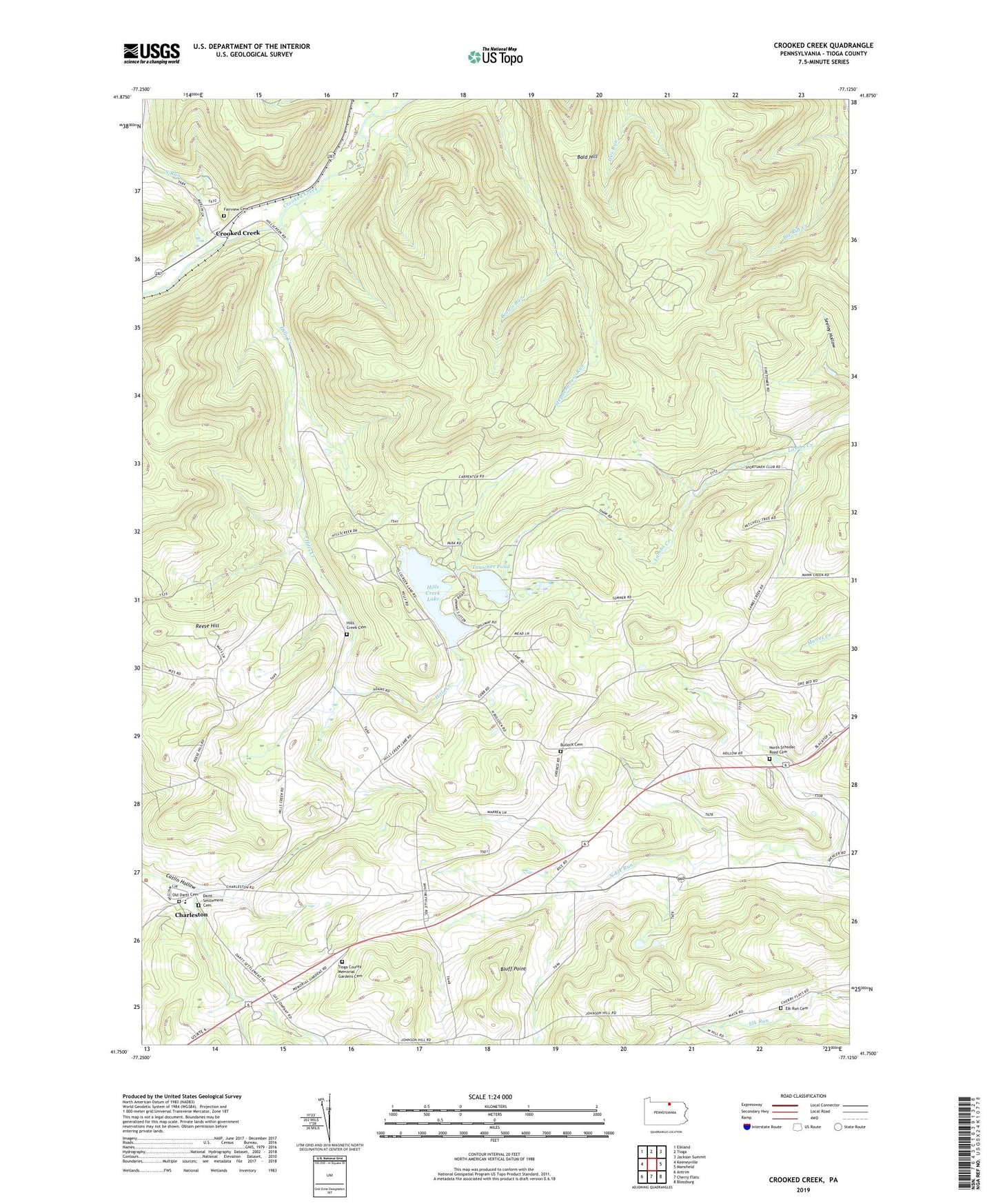
2023 topographic map quadrangle Crooked Creek in the state of Pennsylvania. Scale: 1:24000. Based on the newly updated USGS 7.5' US Topo map series, this map is in the following counties: Tioga. The map contains contour data, water features, and other items you are used to seeing on USGS maps, but also has updated roads and other features. This is the next generation of topographic maps. Printed on high-quality waterproof paper with UV fade-resistant inks.
Quads adjacent to this one:
West: Keeneyville
Northwest: Elkland
North: Tioga
Northeast: Jackson Summit
East: Mansfield
Southeast: Blossburg
South: Cherry Flats
Southwest: Antrim
This map covers the same area as the classic USGS quad with code o41077g2.
Contains the following named places: Bald Hill, Bluff Point, Brown Run, Bullock Cemetery, Charleston, Charleston Consolidated School, Crooked Creek, Dartt Settlement Cemetery, East Charleston Church, Elk Run Cemetery, Fairview Cemetery, Hills Creek, Hills Creek Cemetery, Hills Creek Church, Hills Creek Dam, Hills Creek Lake, Hills Creek State Park, Holiday Station, Mardin, North Run, North Schodac Road Cemetery, Old Dartt Cemetery, Reese Hill, Tauscher Pond, Tioga County Memorial Gardens Cemetery, Township of Charleston, West Covington, Whitneyville