MyTopo
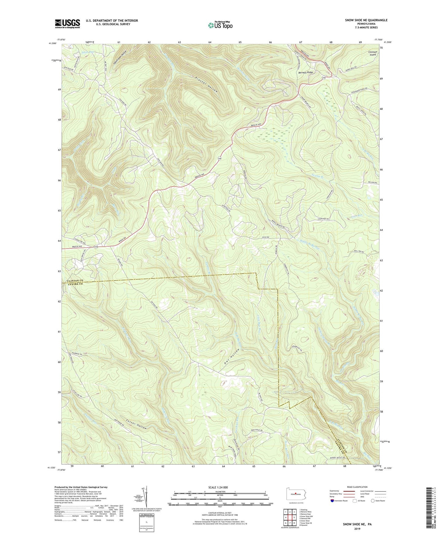
Snow Shoe NE Pennsylvania US Topo Map
Couldn't load pickup availability
2023 topographic map quadrangle Snow Shoe NE in the state of Pennsylvania. Scale: 1:24000. Based on the newly updated USGS 7.5' US Topo map series, this map is in the following counties: Clinton, Centre. The map contains contour data, water features, and other items you are used to seeing on USGS maps, but also has updated roads and other features. This is the next generation of topographic maps. Printed on high-quality waterproof paper with UV fade-resistant inks.
Quads adjacent to this one:
West: Snow Shoe NW
Northwest: Keating
North: Renovo West
Northeast: Renovo East
East: Howard NW
Southeast: Howard
South: Snow Shoe SE
Southwest: Snow Shoe
This map covers the same area as the classic USGS quad with code o41077b7.
Contains the following named places: Bald Hill Hunting Club, Barneys Ridge, Bear Run, Bear Wallow Camps, Bloody Run, Bloody Run Camp, Boiling Spring Camp, Buck Harbor Camp, Burns Run Camp, Camp Big Horn, Camp Chestnut Hill, Camp Podunk, Camp Rockspar, Clear View Camp, Coffin Rock Fire Tower, Coon Run, Coon Run Trail, Deer Lick Camp, Dry Run Camp, Dug Road Trail, East Branch Big Run, Endless Mountain Camp, Fetzer Hollow, Fetzer Hollow Camp, Fish Dam Trail, Fisher Hill Camp, Hendricks Trail, J U Branch, J U Branch Trail, Lewis Camp, Little Bear Run, Little Bear Trail, Little Beaver Camp, Long Trail, Middle Branch Big Run, Owl Hollow, Packer Fork, Panther Branch, Panther Trail, Penrose, Proctor Hollow, Rainbow Trail, Ralphton Camp, Sinking Spring Branch, Smiths Run Trail, Soldiers Home Camp, Sowot Camp, Spike Buck Camp, Spring Run Camp, Sproul State Forest, State Camp, Swamp Branch Trail, The Hemlocks Camp, Triple Oaks Camp, Twin Pines Camp, Tyro Camp, Walker Trail, Weaver Trail, West Branch Big Run, Wildcat Camp, William Penn Camp