MyTopo
Laporte Pennsylvania US Topo Map
Couldn't load pickup availability
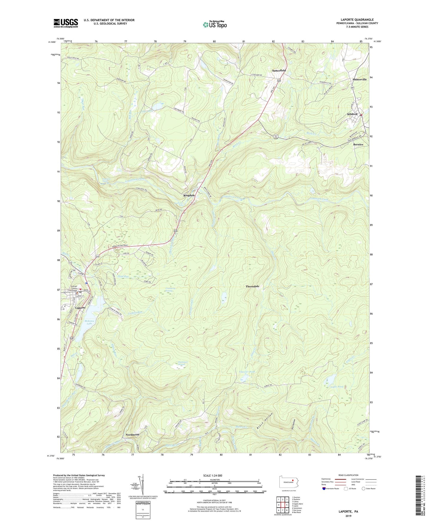
2023 topographic map quadrangle Laporte in the state of Pennsylvania. Scale: 1:24000. Based on the newly updated USGS 7.5' US Topo map series, this map is in the following counties: Sullivan. The map contains contour data, water features, and other items you are used to seeing on USGS maps, but also has updated roads and other features. This is the next generation of topographic maps. Printed on high-quality waterproof paper with UV fade-resistant inks.
Quads adjacent to this one:
West: Eagles Mere
Northwest: Overton
North: Dushore
Northeast: Colley
East: Lopez
Southeast: Red Rock
South: Elk Grove
Southwest: Sonestown
This map covers the same area as the classic USGS quad with code o41076d4.
Contains the following named places: Bernice, Big Run, Birch Creek, Black Hollow, Borough of Laporte, Conklin Run, Cranberry Swamp, Dry Hollow, Dutchman Falls, Dutchman Run, Dutchman Swamp, Elklick Run, Ellis Creek, Floodwood Creek, Foley Corner, Glass Creek, Glass Creek Club, Glass Creek Dam, Glass Creek Pond, Haystacks Rapids, Lake Akela, Lake Mokoma Dam, Laporte, Laporte Post Office, Laporte Volunteer Fire Company Station 50, Lopez Pond, Lopez Pond Branch, Mildred, Mildred Fire Department - Station 58, Mildred Post Office, Mill Run, Mokoma Lake, Muncy Creek, Nordmont, Nordmont Camp, Pennsylvania State Police Troop P Laporte Station, Peters Creek, Ringdale, Rock Run, Saint Francis Church, Saint Pauls Church, Sand Run, Satterfield, Shinerville, South Branch Rock Run, Sullivan Dam, Summit, Thorndale, Township of Laporte, Trinity Church, Tublick Run, ZIP Code: 18632