
MyTopo
Liberty Pennsylvania US Topo Map
Couldn't load pickup availability
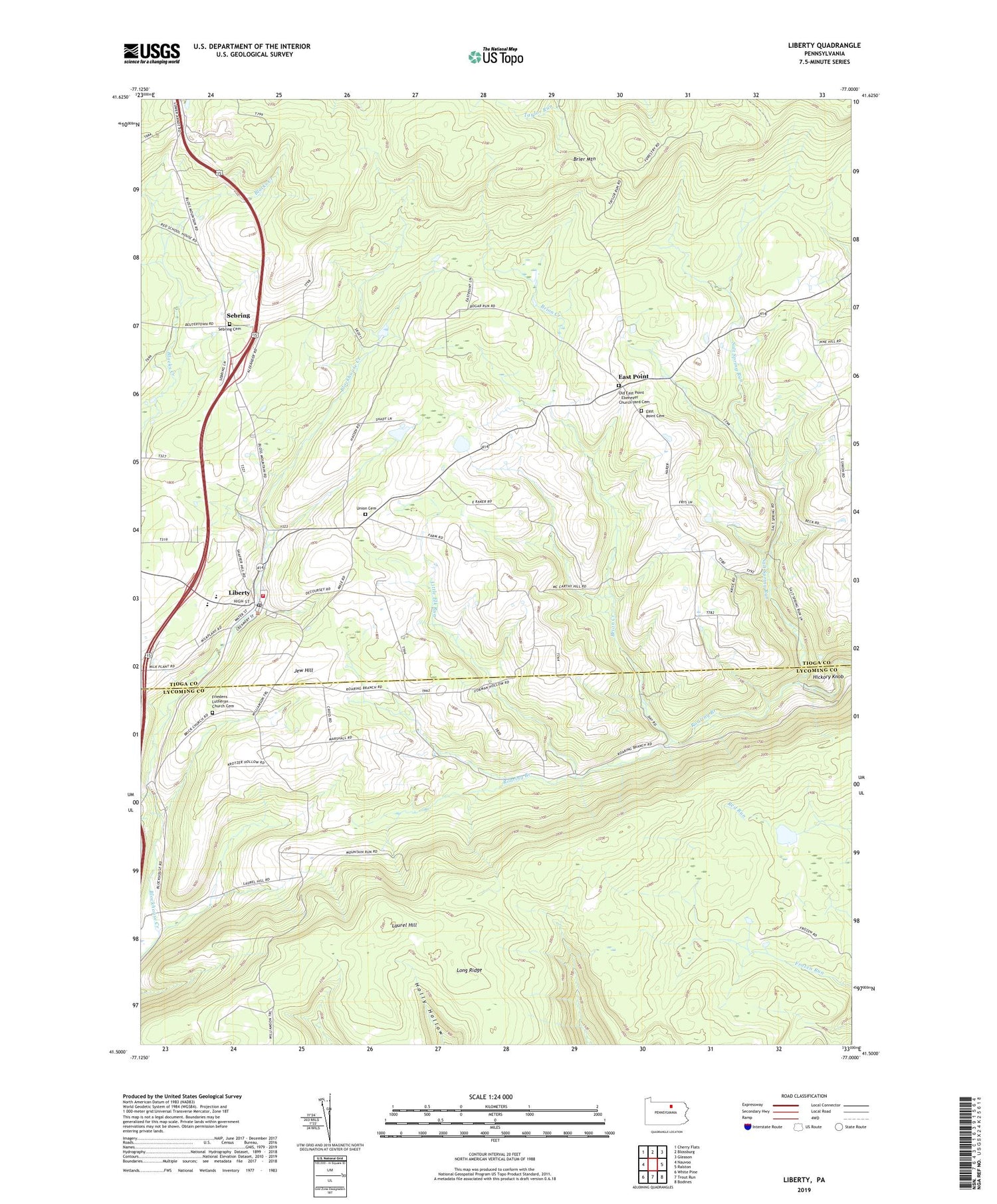
2019 topographic map quadrangle Liberty in the state of Pennsylvania. Scale: 1:24000. Based on the newly updated USGS 7.5' US Topo map series, this map is in the following counties: Tioga, Lycoming. The map contains contour data, water features, and other items you are used to seeing on USGS maps, but also has updated roads and other features. This is the next generation of topographic maps. Printed on high-quality waterproof paper with UV fade-resistant inks.
Quads adjacent to this one:
West: Nauvoo
Northwest: Cherry Flats
North: Blossburg
Northeast: Gleason
East: Ralston
Southeast: Bodines
South: Trout Run
Southwest: White Pine
Contains the following named places: Borough of Liberty, Brier Mountain, Brion Creek, East Point, East Point Cemetery, Friedens Church, Friedens Lutheran Church Cemetery, Greenwood Hunting Club, Harrer School, Henslertown, Hickory Knob, Independence School, Jew Hill, Kahler School, Kings School, Laurel Hill, Liberty, Liberty Junior / Senior High School, Liberty Post Office, Liberty Volunteer Fire Company, Little Elk Run, Long Ridge, Mountain School, Old East Point Cemetery, Salt Spring Run, Sebring, Sebring Cemetery, Skelly School, The Lakes, Township of Jackson, Township of Liberty, Union Cemetery, Union Church, Veilstown


