MyTopo
Russell City Pennsylvania US Topo Map
Couldn't load pickup availability
Also explore the Russell City Forest Service Topo of this same quad for updated USFS data
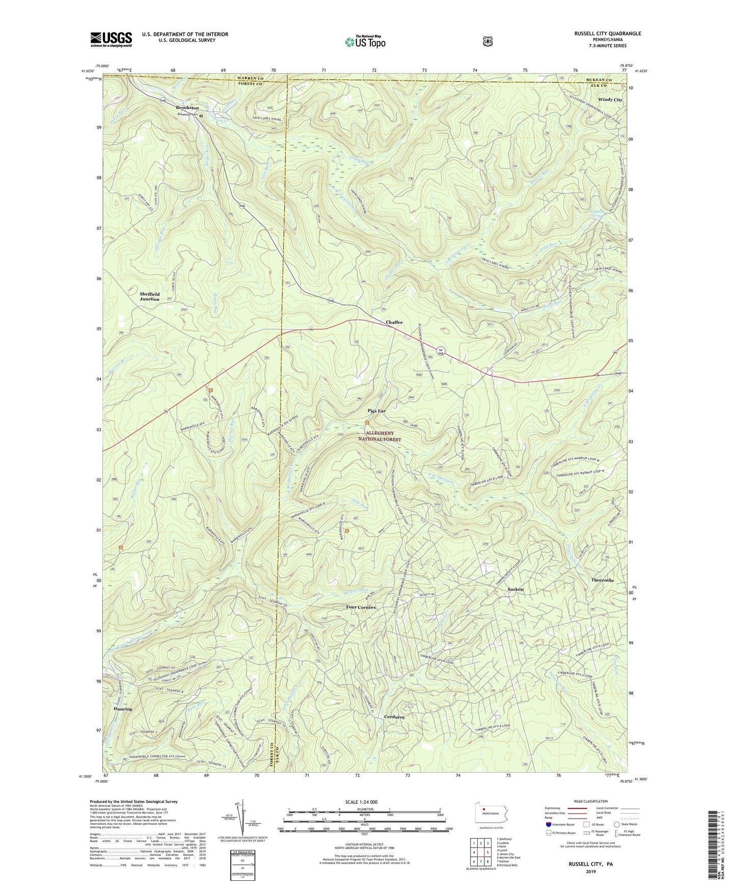
2023 topographic map quadrangle Russell City in the state of Pennsylvania. Scale: 1:24000. Based on the newly updated USGS 7.5' US Topo map series, this map is in the following counties: Elk, Forest, McKean, Warren. The map contains contour data, water features, and other items you are used to seeing on USGS maps, but also has updated roads and other features. This is the next generation of topographic maps. Printed on high-quality waterproof paper with UV fade-resistant inks.
Quads adjacent to this one:
West: Lynch
Northwest: Sheffield
North: Ludlow
Northeast: Kane
East: James City
Southeast: Portland Mills
South: Hallton
Southwest: Marienville East
This map covers the same area as the classic USGS quad with code o41078e8.
Contains the following named places: Bank Run, Bogus Run, Brookston, Brookston Cemetery, Chaffee, Chaffee Run, Coon Run, Corduroy, Crane Run, DeYoung Post Office, Dunring, East Branch Spring Creek, East Fork Run, Eldridge Run, Fork Run, Four Corners, Hi-La Fish Rearing Pool, Iron Run, Martin Run, Pigs Ear, Pine Camp, Pine Run, Rock Run, Russell City, Sackett, Sheffield Junction, Threemile, Threemile Run, Township of Highland, Tuttle Run, Twin Lakes Trail, Wagner Run, Warner Run, West Fork Run, Windy City, Wolf Run, Wolf Run Spring, ZIP Code: 16728