MyTopo
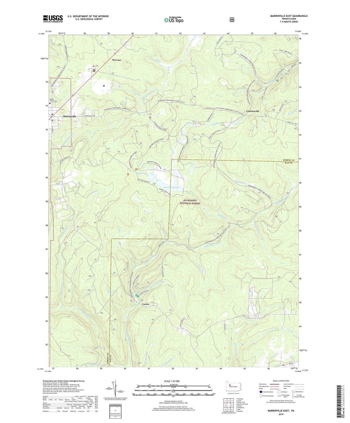
Marienville East Pennsylvania US Topo Map
Couldn't load pickup availability
Also explore the Marienville East Forest Service Topo of this same quad for updated USFS data
2023 topographic map quadrangle Marienville East in the state of Pennsylvania. Scale: 1:24000. Based on the newly updated USGS 7.5' US Topo map series, this map is in the following counties: Forest, Elk. The map contains contour data, water features, and other items you are used to seeing on USGS maps, but also has updated roads and other features. This is the next generation of topographic maps. Printed on high-quality waterproof paper with UV fade-resistant inks.
Quads adjacent to this one:
West: Marienville West
Northwest: Mayburg
North: Lynch
Northeast: Russell City
East: Hallton
Southeast: Munderf
South: Sigel
Southwest: Cooksburg
This map covers the same area as the classic USGS quad with code o41079d1.
Contains the following named places: Brush Creek, Buzzard Swamp, Buzzard Swamp Coop Wildlife Management Area, Crooked Run, Dry Run, Gurgling Run, Jakes Run, Kelly Pines Recreation Area, Lamonaville, Laurel Run, Lick Run, Log Run, Loleta, Loleta Fire Tower, Loleta Interpretive Trail, Loleta Recreation Area, Marienville, Marienville Census Designated Place, Marienville District Ranger Station, Marienville Post Office, Marienville Volunteer Fire Company, McCray Run, McCrays, Muddy Fork, North Forest Cemetery, Penelec Retention Dam, Scott Run, Shippen Run, Sigel Volunteer Fire Department Ward 2 Station 14, Songbird Station Interpretive Trail, Squirrel Run, State Correctional Institution Forest, Steck Run, Sugarcamp Run, Township of Jenks, Township of Millstone, Trout Run, Ung Overbeck Pumping Station, United States Forest Service Marienville Ranger Station, ZIP Code: 15828