MyTopo
McGees Mills Pennsylvania US Topo Map
Couldn't load pickup availability
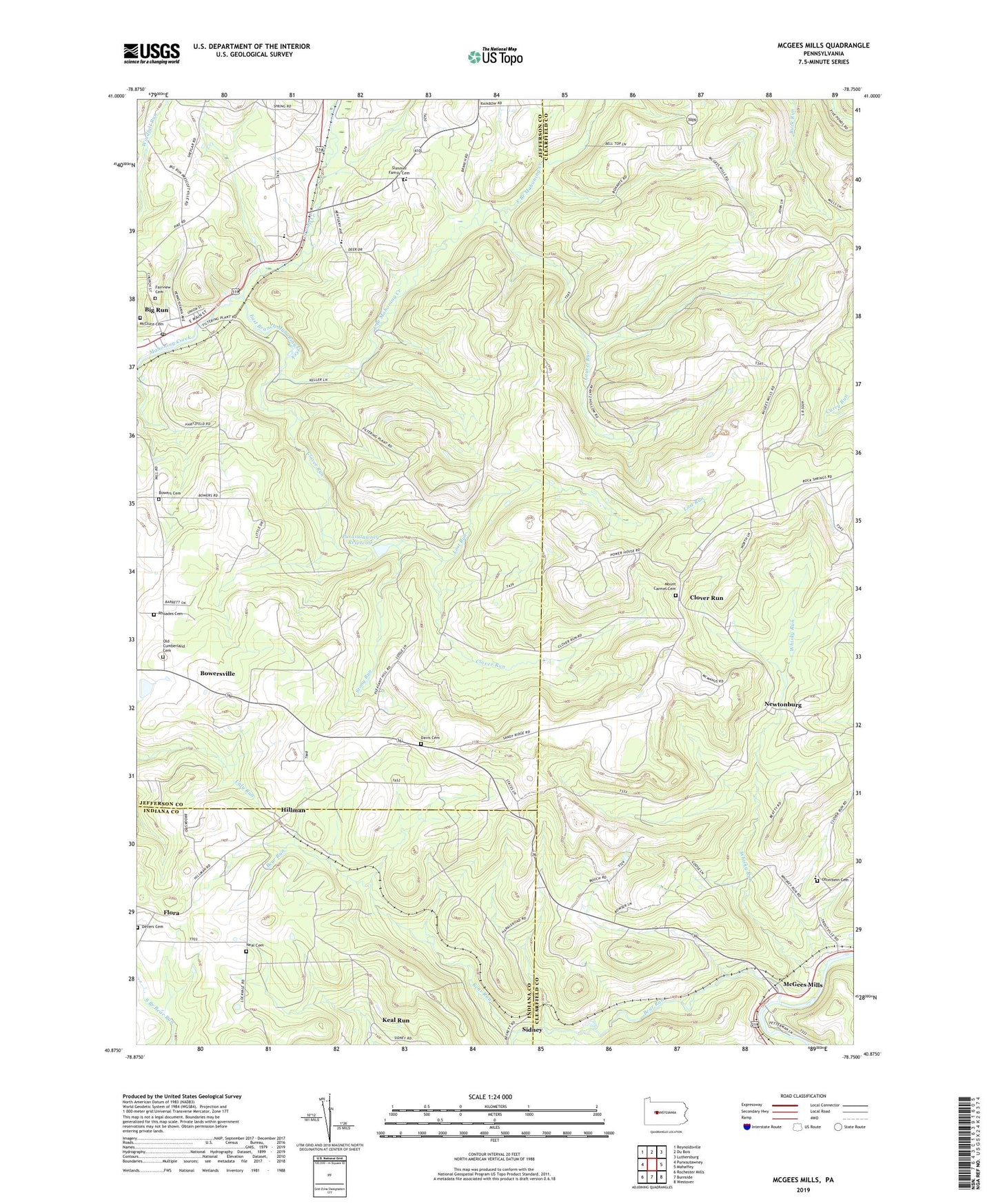
2019 topographic map quadrangle McGees Mills in the state of Pennsylvania. Scale: 1:24000. Based on the newly updated USGS 7.5' US Topo map series, this map is in the following counties: Clearfield, Jefferson, Indiana. The map contains contour data, water features, and other items you are used to seeing on USGS maps, but also has updated roads and other features. This is the next generation of topographic maps. Printed on high-quality waterproof paper with UV fade-resistant inks.
Quads adjacent to this one:
West: Punxsutawney
Northwest: Reynoldsville
North: Du Bois
Northeast: Luthersburg
East: Mahaffey
Southeast: Westover
South: Burnside
Southwest: Rochester Mills
Contains the following named places: Bear Run, Big Run Post Office, Bowers Cemetery, Bowersville, Bucheit School, Clover Dam, Clover Run, Davis Cemetery, Davis School, Devers Cemetery, East Branch Mahoning Creek, Fairview Cemetery, Flora, Henderson School, Hillman, Junction Bear Run Branch Station, Keal Run, Laurel Run, Lost Run, Lower Bucheit School, McClure Cemetery, McGees Mills, McGees Station, Mount Carmel Cemetery, Mount Pleasant Church, Neal Cemetery, Newtonburg, Old Cumberland Cemetery, Otterbein Cemetery, Otterbein Church, Pleasantville School, Punxsutawney Reservoir, Rhoades Cemetery, Schlimmer School, Sidney, Slimmer Family Cemetery, South Branch Bear Run, State Game Lands Number 174, State Game Lands Number 195, Stony Run, Stump Creek, Township of Bell, Township of Gaskill, Wainwright School, Whisky Run