MyTopo
Rochester Mills Pennsylvania US Topo Map
Couldn't load pickup availability
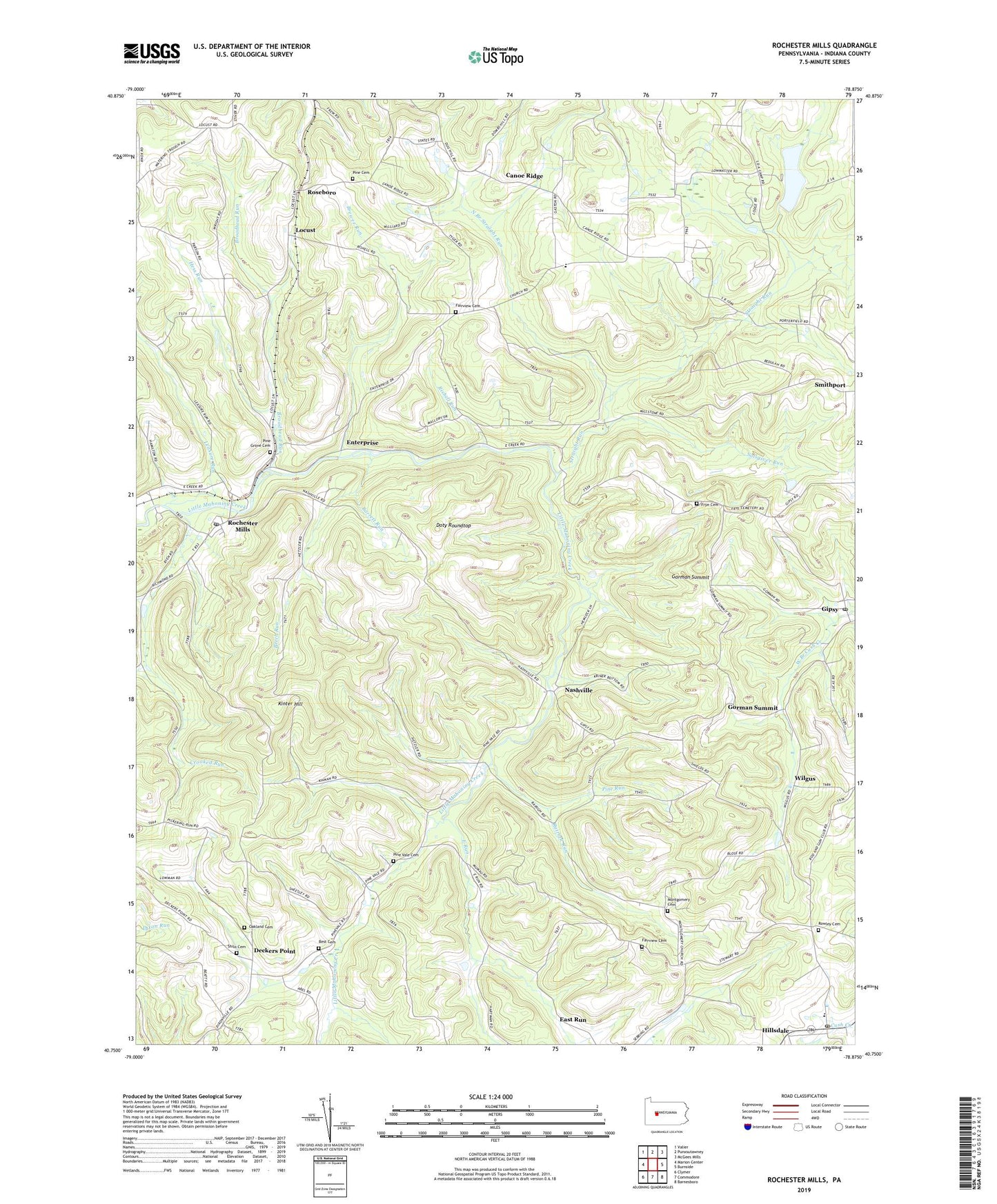
2023 topographic map quadrangle Rochester Mills in the state of Pennsylvania. Scale: 1:24000. Based on the newly updated USGS 7.5' US Topo map series, this map is in the following counties: Indiana. The map contains contour data, water features, and other items you are used to seeing on USGS maps, but also has updated roads and other features. This is the next generation of topographic maps. Printed on high-quality waterproof paper with UV fade-resistant inks.
Quads adjacent to this one:
West: Marion Center
Northwest: Valier
North: Punxsutawney
Northeast: McGees Mills
East: Burnside
Southeast: Barnesboro
South: Commodore
Southwest: Clymer
This map covers the same area as the classic USGS quad with code o40078g8.
Contains the following named places: Antioch Church, Barrett Run, Beech Run, Best Cemetery, Brewer Run, Brinkell School, Broadhead Run, Calvary Church, Canoe Grant School, Canoe Ridge, Crawford School, Crooked Run, Deckers Point, Doty Roundtop, East Run, Enterprise, Fairview Cemetery, Fairview Church, Fairview School, Frye Cemetery, Gaston School, Gipsy, Gipsy Post Office, Gorman Summit, Hartman School, Hemlock Lake County Park, Henry School, Hess Run, Hillsdale, Hillsdale Church, Hillsdale Post Office, Kinter Hill, Leasure Run, Locust, Montgomery Cemetery, Montgomery Church, Nashville, North Branch Straight Run, Oakland Cemetery, Pine Cemetery, Pine Church, Pine Grove Cemetery, Pine Run, Pine Vale Cemetery, Pinevale Church, Rairigh Run, Rishell Run, Robertsville, Rochester Mills, Rochester Mills Post Office, Roseboro, Rowley Cemetery, Ruffener School, Salsgiver Run, Savan, Shilo Cemetery, Smithport, South Branch Cush Creek, State Game Lands Number 262, Straight Run, Straight Run Dam, Straight Run Lake, Township of Canoe, Township of Grant, Wilgus, ZIP Codes: 15741, 15746, 15771, 15772