MyTopo
Saltsburg Pennsylvania US Topo Map
Couldn't load pickup availability
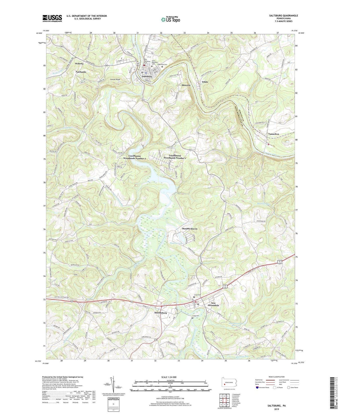
2023 topographic map quadrangle Saltsburg in the state of Pennsylvania. Scale: 1:24000. Based on the newly updated USGS 7.5' US Topo map series, this map is in the following counties: Westmoreland, Indiana. The map contains contour data, water features, and other items you are used to seeing on USGS maps, but also has updated roads and other features. This is the next generation of topographic maps. Printed on high-quality waterproof paper with UV fade-resistant inks.
Quads adjacent to this one:
West: Slickville
Northwest: Vandergrift
North: Avonmore
Northeast: McIntyre
East: Blairsville
Southeast: Derry
South: Latrobe
Southwest: Greensburg
This map covers the same area as the classic USGS quad with code o40079d4.
Contains the following named places: Borough of New Alexandria, Borough of Saltsburg, Conemaugh River, Crabtree Creek, Craig Cemetery, Edgewood Cemetery, Elders Run, Fairbanks, Fennelltown Church, Getty Run, Keystone Dam, Keystone Park Dam, Keystone Run, Kiskiminetas Spring School, Lifestat Ambulance Service, Locust Knob, Loyalhanna Creek, Loyalhanna Dam, Loyalhanna Lake National Recreation Area, Loyalhanna Woodlands Number 1, Loyalhanna Woodlands Number 2, Manitto Haven, Mannitto Lake, Metzgar Elementary School, Moween, Mutual Aid Ambulance Service New Alexandria, New Alexandria, New Alexandria Post Office, New Alexandria Reservoir, New Alexandria Union Cemetery, New Alexandria Volunteer Fire Department Station 77, Nihil, Old Saltsburg Cemetery, Saint Matthew's Cemetery, Saltsburg, Saltsburg Elementary School, Saltsburg Post Office, Saltsburg Volunteer Fire Department Station 131, Serviceberry Run, Shieldsburg, Slybac E O C Airport, Township of Loyalhanna, Tunnelton, Tunnelton Conemaugh Township Volunteer Fire Department Station 330, Wakena, White, Whitethorn Creek, Willard School, ZIP Code: 15670