MyTopo
McCoysville Pennsylvania US Topo Map
Couldn't load pickup availability
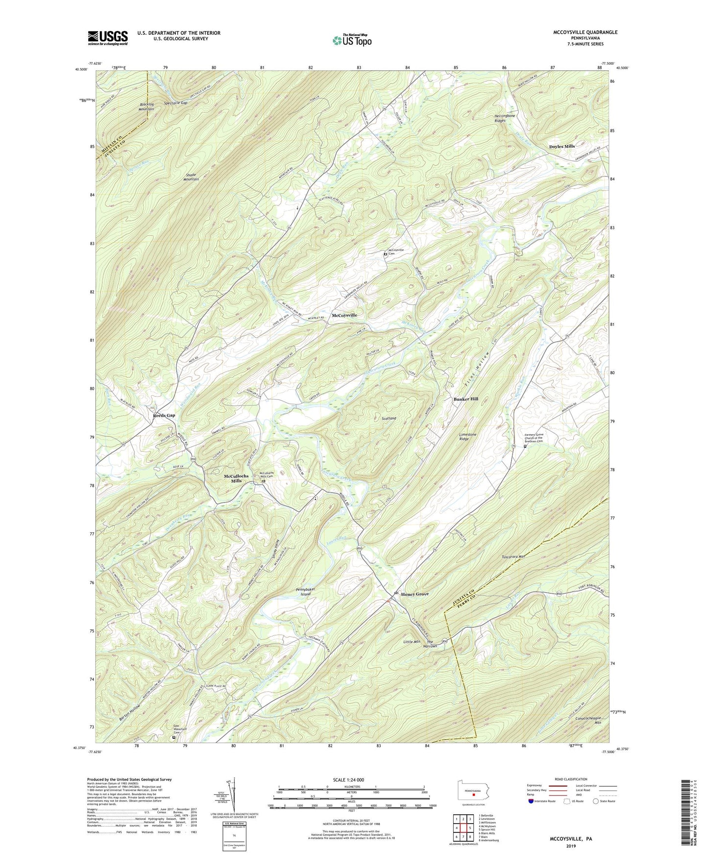
2023 topographic map quadrangle McCoysville in the state of Pennsylvania. Scale: 1:24000. Based on the newly updated USGS 7.5' US Topo map series, this map is in the following counties: Juniata, Perry, Mifflin. The map contains contour data, water features, and other items you are used to seeing on USGS maps, but also has updated roads and other features. This is the next generation of topographic maps. Printed on high-quality waterproof paper with UV fade-resistant inks.
Quads adjacent to this one:
West: McVeytown
Northwest: Belleville
North: Lewistown
Northeast: Mifflintown
East: Spruce Hill
Southeast: Andersonburg
South: Blain
Southwest: Blairs Mills
This map covers the same area as the classic USGS quad with code o40077d5.
Contains the following named places: Barn Run, Bunker Hill, Bunker Hill School, Cross Bar Trail, Divide Trail, Dougherty Run, Doyles Mills, East Waterford Cemetery, Farmers Grove Church, Farmers Grove Church of the Brethren Cemetery, Flint Hollow, Herringbone Ridges, Honey Grove, Honey Grove Post Office, Laurel Run, Little Mountain, Little Valley Creek, McCoysville, McCoysville Cemetery, McCullochs Mills, McCullochs Mills Cemetery, McKinley Run, McKinley School, Path, Pennybaker Island, Reeds Gap, Reeds School, Rock Church, Scotland, Shade Mountain, Smoky Valley, Spectacle Gap, State Game Lands Number 88, The Narrows, Township of Tuscarora, Union School, Warble Run, Willow Run, Woodward Run, ZIP Code: 17035