MyTopo
Lewistown Pennsylvania US Topo Map
Couldn't load pickup availability
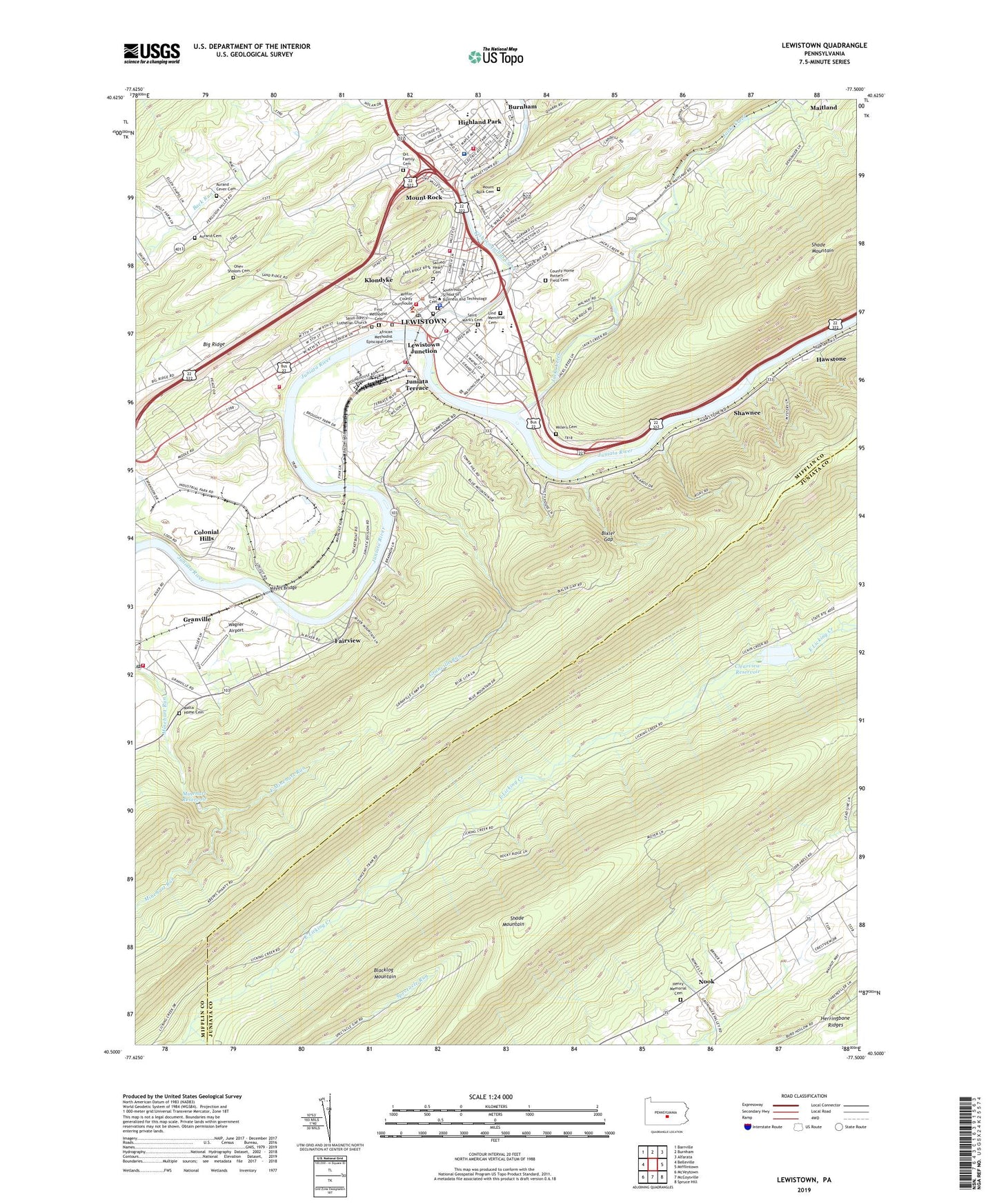
2023 topographic map quadrangle Lewistown in the state of Pennsylvania. Scale: 1:24000. Based on the newly updated USGS 7.5' US Topo map series, this map is in the following counties: Mifflin, Juniata. The map contains contour data, water features, and other items you are used to seeing on USGS maps, but also has updated roads and other features. This is the next generation of topographic maps. Printed on high-quality waterproof paper with UV fade-resistant inks.
Quads adjacent to this one:
West: Belleville
Northwest: Barrville
North: Burnham
Northeast: Alfarata
East: Mifflintown
Southeast: Spruce Hill
South: McCoysville
Southwest: McVeytown
This map covers the same area as the classic USGS quad with code o40077e5.
Contains the following named places: African Methodist Episcopal Cemetery, Aurand - Cever Cemetery, Aurand Airport, Aurand Cemetery, Aurand School, Bixler Gap, Black Hospital, Borough of Juniata Terrace, Borough of Lewistown, Brooklyn Hose Company Station 13, Buchanan Elementary School, Chief Logan School, City Hook and Ladder Company Station 14, Clearview Reservoir, Colonial Hills, County Home Potters Field Cemetery, East Minehart Run, Ellen Chapel, Fairview, Fairview Church, Fame Emergency Medical Services Station 12, First Methodist Cemetery, Footbridge Trail, Forsythe School, Glenwood Church, Granville Census Designated Place, Granville Church, Granville Fire Company Station 16, Granville Post Office, Granville Run, Guss Picnic Area, Hawstone, Henry Memorial Cemetery, Highland Park, Highland Park Census Designated Place, Highland Park Hose Company Station 4, Jacks Creek, Jenson Field, Junction Fire Company Station 15, Juniata Terrace, Kishacoquillas Creek, Klondyke, Lake Park Church, Lewistown, Lewistown Junction, Lewistown Police Department, Lewistown Post Office, Licking Creek Dam, Lind Memorial Cemetery, Logan School, Maitland Census Designated Place, Malta Home Cemetery, Mayes Bridge, McCoys Ford, Mifflin County, Millers Cemetery, Minehart Dam, Minehart Reservoir, Mount Rock, Mount Rock Cemetery, Nook, Ohev Sholom Cemetery, Ort Family Cemetery, Pa-67 Dam, Parkview Church, Pennsylvania State Fire Academy, Sacred Heart Cemetery, Sacred Heart School, Saint John's Lutheran Church Cemetery, Saint Mark's Cemetery, Saint Mark's Columbarium, Saint Pauls Church, Seventh Ward Elementary School, Shade Mountain Fire Tower, Shawnee, Shippen Hall, Spectacle Run, Town Cemetery, Township of Beale, Township of Granville, Trinity Church, United Fire and Rescue Services Station 11, Vincent Tram Trail, Wagner Airport, WKVA-AM (Lewistown), WMRF-AM (Lewistown), ZIP Codes: 17029, 17044, 17058