MyTopo
Swatara Hill Pennsylvania US Topo Map
Couldn't load pickup availability
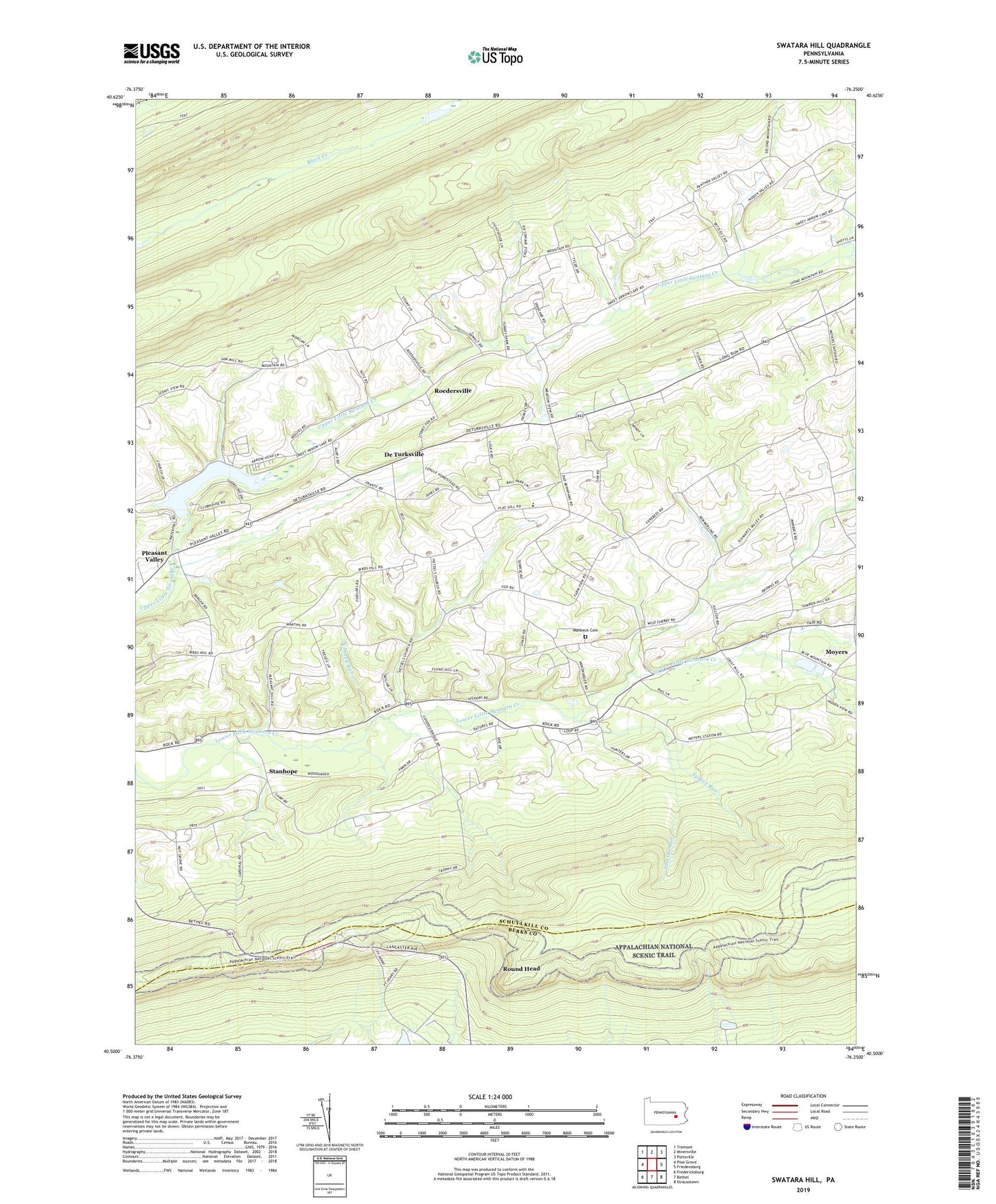
2023 topographic map quadrangle Swatara Hill in the state of Pennsylvania. Scale: 1:24000. Based on the newly updated USGS 7.5' US Topo map series, this map is in the following counties: Schuylkill, Berks. The map contains contour data, water features, and other items you are used to seeing on USGS maps, but also has updated roads and other features. This is the next generation of topographic maps. Printed on high-quality waterproof paper with UV fade-resistant inks.
Quads adjacent to this one:
West: Pine Grove
Northwest: Tremont
North: Minersville
Northeast: Pottsville
East: Friedensburg
Southeast: Strausstown
South: Bethel
Southwest: Fredericksburg
This map covers the same area as the classic USGS quad with code o40076e3.
Contains the following named places: Applebee Shelter, Blue Blazed Trail, Cider Field Airport, Conrad Weiser Branch, De Turksville, Eagel View Springs Golf Course, Eagle View Springs Golf Course, Foxs Path, Hauers Church, Hertline Shelter, Hidden Valley Golf Course, Iron Ore Run, Paradise Church, Pleasant Valley, Rock, Roedersville, Round Head, Saint Marks Church, Salem Church, Schneck Run, Schweigerts School, Spruce Run, Stanhope, State Game Lands Number 160, Stone Ridge, Summer Hill, Swatara Hill, Sweet Arrow Lake, Sweet Arrow Lake Dam, Township of Washington, Upper Little Swatara Creek, Werts Path, Zion Church, Zion Evangelical Cemetery, ZIP Code: 19507