MyTopo
Young Womans Creek Pennsylvania US Topo Map
Couldn't load pickup availability
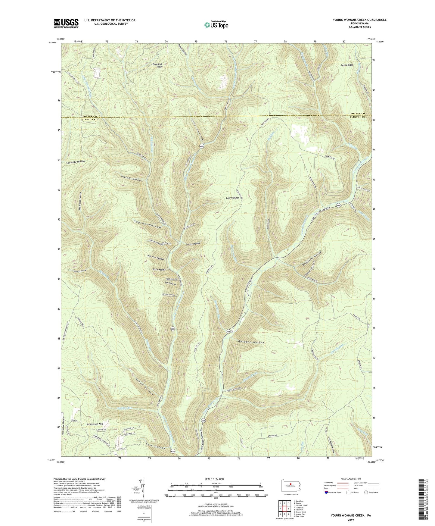
2023 topographic map quadrangle Young Womans Creek in the state of Pennsylvania. Scale: 1:24000. Based on the newly updated USGS 7.5' US Topo map series, this map is in the following counties: Clinton, Potter. The map contains contour data, water features, and other items you are used to seeing on USGS maps, but also has updated roads and other features. This is the next generation of topographic maps. Printed on high-quality waterproof paper with UV fade-resistant inks.
Quads adjacent to this one:
West: Tamarack
Northwest: Short Run
North: Oleona
Northeast: Lee Fire Tower
East: Slate Run
Southeast: Glen Union
South: Renovo East
Southwest: Renovo West
This map covers the same area as the classic USGS quad with code o41077d6.
Contains the following named places: Ash Hollow, Ash Hollow Trail, Bee Tree Hollow, Beechwood Trail, Big Spring Branch, Birch Hollow, Bull Run, Butler Hollow, Calamity Hollow, Camp Trail, Cannon Hole Trail, Daugherty Hollow, Daugherty Hollow Trail, Dug Road Trail, Fork Hill Trail, French Trail, Fye Camp Trail, Geyser Hollow, Ginseng Hollow, Greenlick Run, Ingram Hollow, Italian Hollow Trail, Laurel Fork, Laurel Ridge, Laurelly Fork, Laurelly Hill Trail, Lebo Run, Lecox Ridge, Lecox Ridge Trail, Lee Hollow Trail, Little Boyer Mill Trail, Little Greenlick Run, Long Fork Trail, Long Hollow, McCraney Run, Merriman Hollow, Mix Hollow Trail, Morgan Hollow Trail, Mudlick Run, Mudlick Trail, Oxbow Hollow, Oxbow Hollow Trail, Patchell Trail, Poplar Hollow, Post Hollow, Quiggle Hollow, Rands Hole Trail, Rattlesnake Trail, Shaney Brook, Shaney Brook Trail, Shingle Branch, Shingle Mill Hollow Trail, Spring Brook, Stible Hole Trail, Stout Hollow, Stout Hollow Trail, Summerson Mountain, Summerson Run, Tegerman Hollow, Township of Chapman, Wildcat Trail, ZIP Code: 17760