MyTopo
Roseville Pennsylvania US Topo Map
Couldn't load pickup availability
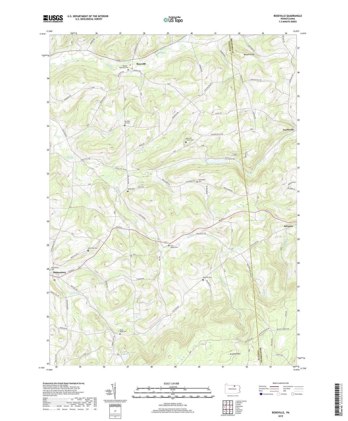
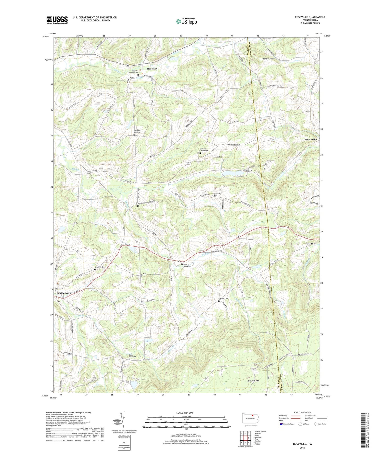
2019 topographic map quadrangle Roseville in the state of Pennsylvania. Scale: 1:24000. Based on the newly updated USGS 7.5' US Topo map series, this map is in the following counties: Tioga, Bradford. The map contains contour data, water features, and other items you are used to seeing on USGS maps, but also has updated roads and other features. This is the next generation of topographic maps. Printed on high-quality waterproof paper with UV fade-resistant inks.
Quads adjacent to this one:
West: Mansfield
Northwest: Jackson Summit
North: Millerton
Northeast: Gillett
East: Troy
Southeast: Canton
South: Gleason
Southwest: Blossburg
Contains the following named places: Ames Hill Cemetery, Armenia Church, Bear Creek, Benson Knob, Borough of Roseville, Elk Run Church, Gaffers Creek, Gray Valley School, Grays Valley Post Office, Grey Valley Cemetery, Hulslander Cemetery, King Hill Cemetery, Mainesburg, Mainesburg Post Office, Mansfield Church, Reynolds Cemetery, Roseville, Rutland Post Office, Smith Cemetery, State Road Cemetery, State Road Church, Township of Sullivan, Union Church, Watson - Roseville Cemetery, Wood Cemetery, ZIP Code: 16932