MyTopo
Roulette Pennsylvania US Topo Map
Couldn't load pickup availability
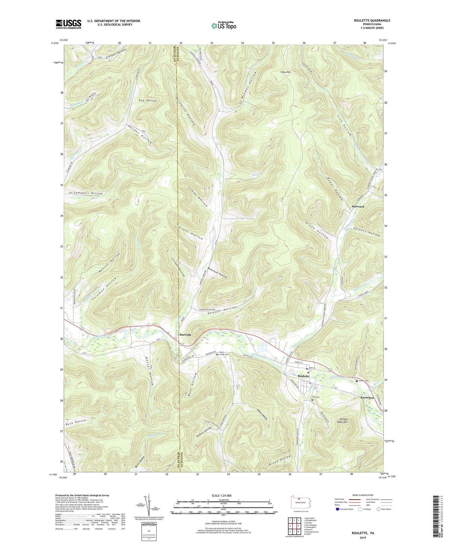
2019 topographic map quadrangle Roulette in the state of Pennsylvania. Scale: 1:24000. Based on the newly updated USGS 7.5' US Topo map series, this map is in the following counties: Potter, McKean. The map contains contour data, water features, and other items you are used to seeing on USGS maps, but also has updated roads and other features. This is the next generation of topographic maps. Printed on high-quality waterproof paper with UV fade-resistant inks.
Quads adjacent to this one:
West: Port Allegany
Northwest: Bullis Mills
North: Shinglehouse
Northeast: Oswayo
East: Coudersport
Southeast: Austin
South: Keating Summit
Southwest: Norwich
Contains the following named places: Allard Hollow, Baker Hollow, Bear Creek, Beckwith Hollow, Benson Hollow, Brown Hollow, Buck Run, Burch Hollow, Burt Hollow, Burtville, Card Creek, Card Creek Cemetery, Card Creek School, Clara Hill, Coleman Creek, Coleman Hollow, Dexter Hollow, Durward, East Branch Fishing Creek, Ernst Hollow, Fishing Creek, Fishing Creek Church, Fishing Creek School, Fisk Hollow, Fisk Hollow Run, Gleason Hollow, Green Hollow, Guy Hollow, Hackett Hollow, Hanson Hollow, Hardes Hollow, Hill Cemetery, Jordan Hollow, Knowlton, Laninger Creek, Leman Hollow, Lyman Cemetery, Meacham Hollow, Nichols Hollow, Riverside Church, Roulette, Roulette Census Designated Place, Roulette Chemical Engine Company Station 46, Roulette Post Office, Sartwell Creek, Sartwell Creek Church, Shingle Cabin Hill, Smith School, State Game Lands Number 59, Township of Pleasant Valley, Township of Roulette, Trout Brook, Weimer School, Wiemer Hollow, Williston, ZIP Code: 16743