MyTopo
Sonestown Pennsylvania US Topo Map
Couldn't load pickup availability
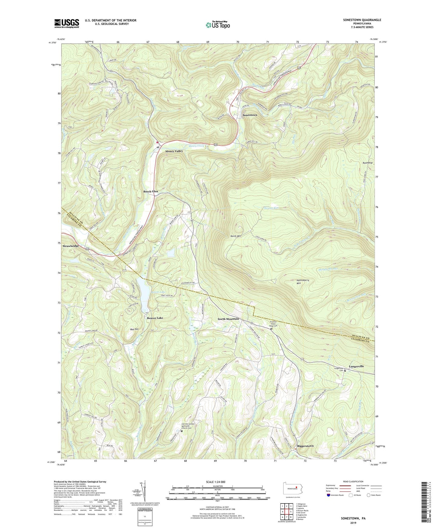
2019 topographic map quadrangle Sonestown in the state of Pennsylvania. Scale: 1:24000. Based on the newly updated USGS 7.5' US Topo map series, this map is in the following counties: Sullivan, Lycoming. The map contains contour data, water features, and other items you are used to seeing on USGS maps, but also has updated roads and other features. This is the next generation of topographic maps. Printed on high-quality waterproof paper with UV fade-resistant inks.
Quads adjacent to this one:
West: Picture Rocks
Northwest: Hillsgrove
North: Eagles Mere
Northeast: Laporte
East: Elk Grove
Southeast: Benton
South: Lairdsville
Southwest: Hughesville
Contains the following named places: Bad Hill, Beaver Lake, Beaver Lake Dam, Beech Glen, Big Run, Biggerstown, Buck Run, Bully Run, Deep Hollow Run, Fairview Church, Fairview United Methodist Church Cemetery, Franklin Church, Franklin Stone Heap Cemetery, Hemlock Grove, Hemlock Run, Kedron Church, Lungerville, Lungerville Cemetery, Marsh Run, Mosey Run, Muncy Valley, Muncy Valley Area Volunteer Fire Company Station 52, Muncy Valley Post Office, North Mountain, Slip Run, Sonestown, Spring Run, State Game Lands Number 13, Straw, Strawbridge, Swanks Run, The Outlet, Trout Run, West Branch Little Muncy Creek, West Creek, ZIP Codes: 17758, 17774