MyTopo
Barnesboro Pennsylvania US Topo Map
Couldn't load pickup availability
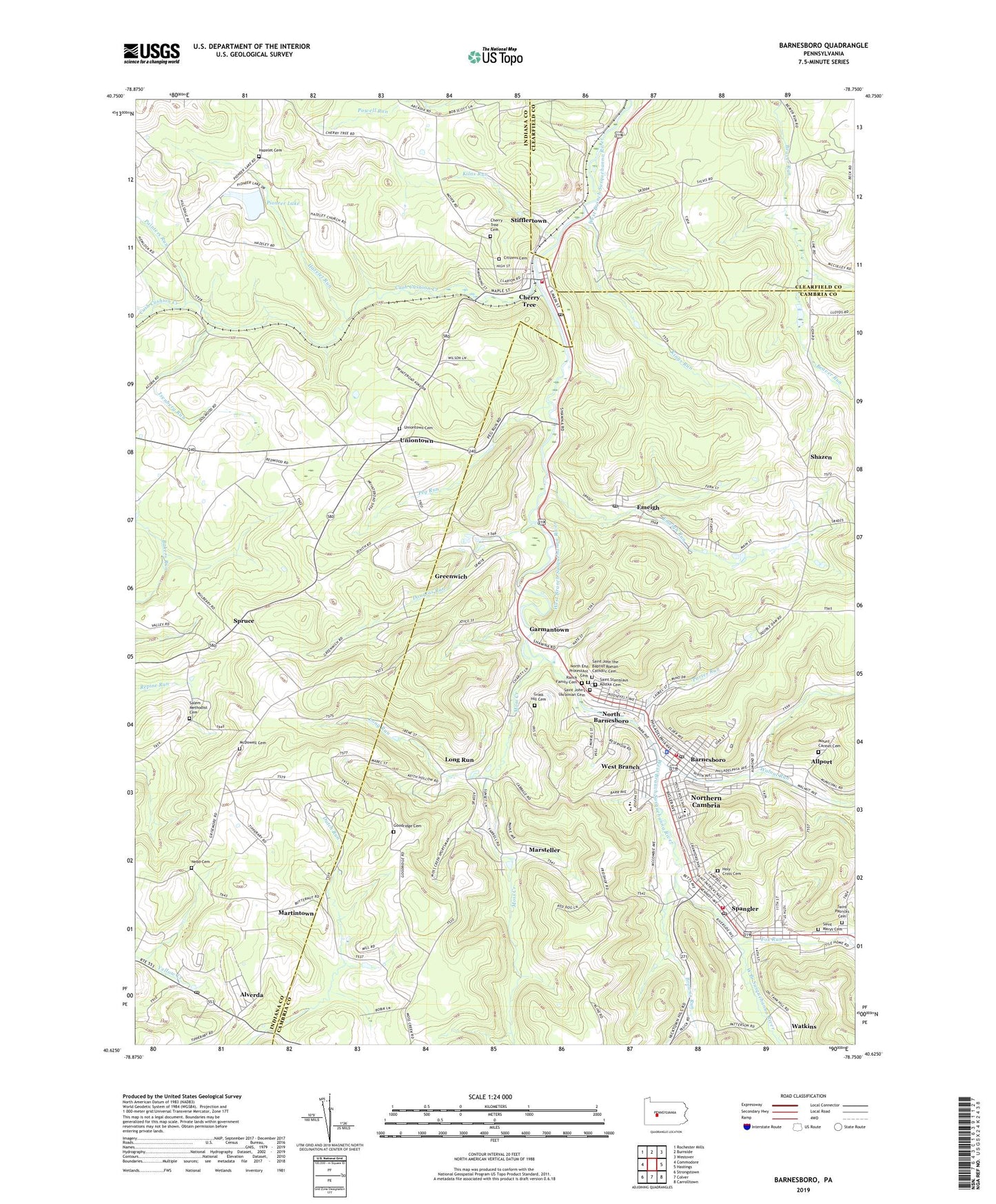
2023 topographic map quadrangle Barnesboro in the state of Pennsylvania. Scale: 1:24000. Based on the newly updated USGS 7.5' US Topo map series, this map is in the following counties: Cambria, Indiana, Clearfield. The map contains contour data, water features, and other items you are used to seeing on USGS maps, but also has updated roads and other features. This is the next generation of topographic maps. Printed on high-quality waterproof paper with UV fade-resistant inks.
Quads adjacent to this one:
West: Commodore
Northwest: Rochester Mills
North: Burnside
Northeast: Westover
East: Hastings
Southeast: Carrolltown
South: Colver
Southwest: Strongstown
This map covers the same area as the classic USGS quad with code o40078f7.
Contains the following named places: Allport, Alverda, Alverda Census Designated Place, Alverda Post Office, Barnesboro, Beringer, Borough of Barnesboro, Borough of Cherry Tree, Borough of Northern Cambria, Borough of Spangler, Browns Run, Calvary Church, Cherry Tree, Cherry Tree Cemetery, Cherry Tree Post Office, Cherry Tree Reservoir, Cherry Tree Volunteer Fire Department Station 520, Citizens Cemetery, Cush Cushion, Cush Cushion Creek, Cush Cushion Crossing, Douglas Run, Emeigh, Emeigh Post Office, Emeigh Run, Fox Run, Garmans Mills, Garmantown, Goodridge Cemetery, Grant, Grass Hill Cemetery, Greenwich, Grip, Hazelet Cemetery, Hazelet Church, Hazelet Run, Health Ride Plus Transportation Service, Holy Cross Cemetery, Holy Cross School, Hope Fire Company Station 50, Isenberg Run, Kilns Run, Kings Run, Living Waters Camp, Long Run, Marsteller, Martintown, McDowell Cemetery, Mckeage Dam, McKeages Crossing, Med - Van Transport Ambulance, Miners Hospital, Moss Creek, Mount Carmel Cemetery, Nebo Cemetery, North Barnesboro, North End Protestant Cemetery, Northern Cambria, Northern Cambria Borough Police Department, Northern Cambria High School, Northern Cambria Post Office, Painters Run, Peg Run, Pine Grove Church, Pioneer Lake, Pioneer Lake Dam, Pleasant View Church, Porter Run, Ranck Family Cemetery, Roosevelt School, Saint John the Baptist Roman Catholic Cemetery, Saint Johns School, Saint John's Ukrainian Cemetery, Saint Marys Cemetery, Saint Patricks Cemetery, Saint Patricks School, Saint Stanislas School, Saint Stanislaus Kostka Cemetery, Salem Church, Salem Methodist Cemetery, Shazen, Spangler, Spangler Fire Company Station 58, Spangler Post Office, Spruce, State Game Lands Number 185, Stifflertown, Township of Susquehanna, Uniontown, Uniontown Cemetery, Veterans Memorial Ambulance Service Station 68, Walnut Run, Watkins, West Branch, Wood Ridge Church, ZIP Codes: 15710, 15714, 15724, 15738, 15760, 15775