MyTopo
Tyrone Pennsylvania US Topo Map
Couldn't load pickup availability
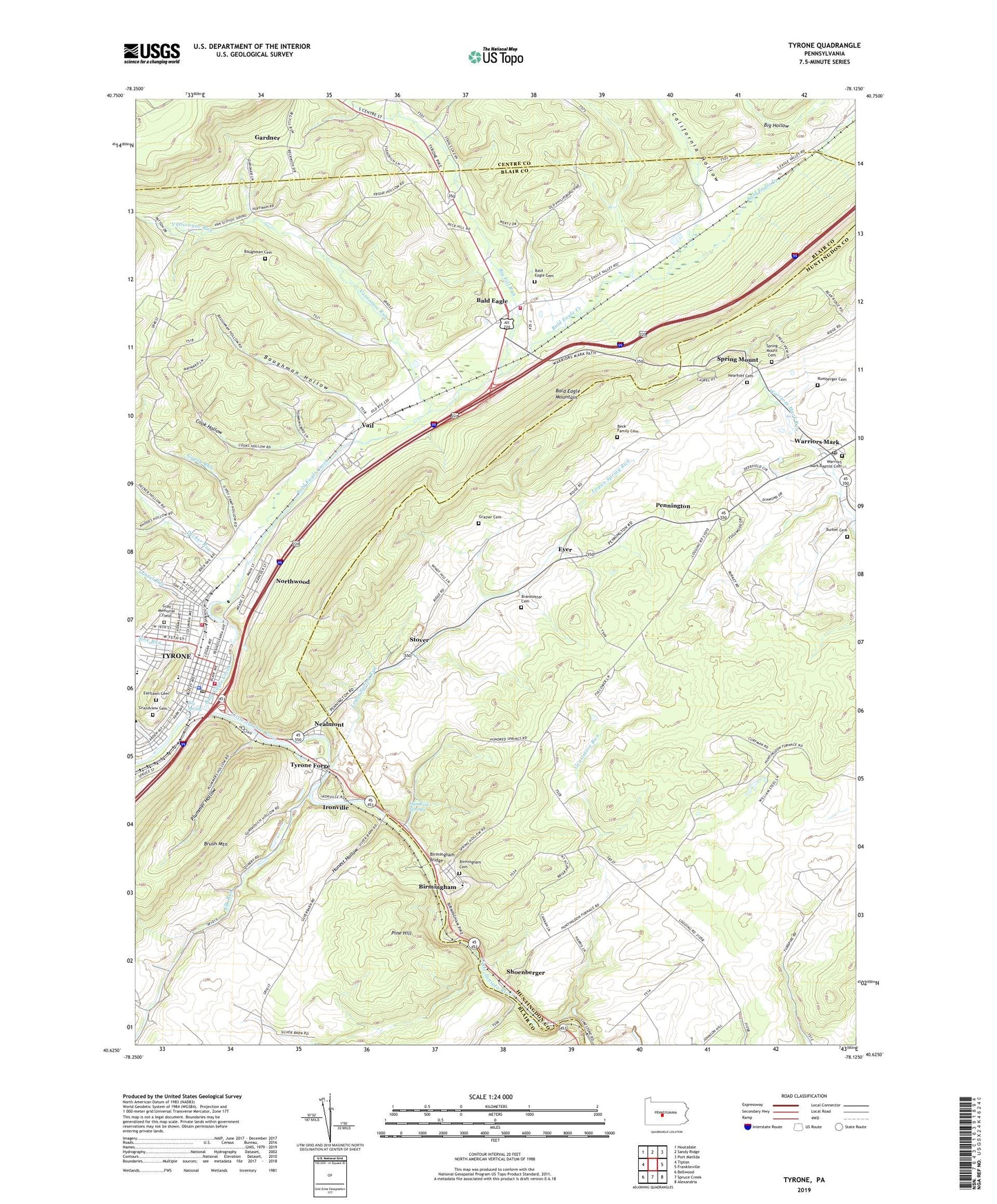
2019 topographic map quadrangle Tyrone in the state of Pennsylvania. Scale: 1:24000. Based on the newly updated USGS 7.5' US Topo map series, this map is in the following counties: Blair, Huntingdon, Centre. The map contains contour data, water features, and other items you are used to seeing on USGS maps, but also has updated roads and other features. This is the next generation of topographic maps. Printed on high-quality waterproof paper with UV fade-resistant inks.
Quads adjacent to this one:
West: Tipton
Northwest: Houtzdale
North: Sandy Ridge
Northeast: Port Matilda
East: Franklinville
Southeast: Alexandria
South: Spruce Creek
Southwest: Bellwood
Contains the following named places: Adams Elementary School, Altoona Mobile Emergency Department Authority Station 400 Tyrone Substation, Anderson Camp, Bald Eagle, Bald Eagle Cemetery, Bald Eagle Census Designated Place, Bald Eagle Creek, Bald Eagle Volunteer Fire Company Station 36, Baughman Cemetery, Baughman Hollow, Beck Family Cemetery, Big Fill Run, Big Spring, Birmingham, Birmingham Bridge, Birmingham Cemetery, Blazing Arrow Hook and Ladder Fire Company Station 33, Borough of Birmingham, Borough of Tyrone, Branstetter Cemetery, Bright Run, Burket Cemetery, Cabin Ford School, California Hollow, Cook Hollow, Decker Run, Eastlawn Cemetery, Elk Run, Eyer, Gardner, Gensimore Run, Grandview Cemetery, Gray Memorial Field, Grazier Cemetery, Grier School, Gypsy Run, Hickory Bottom School, Honest Hollow, Hundred Springs, Ironville, Ironville Census Designated Place, Kinch School, Laurel Run, Lincoln Elementary School, Logan Elementary School, Logan Spring Run, Main School, McKenrick Mills, Mountain Orchards School, Nealmont, Nealmont Census Designated Place, Nearhoff Cemetery, Northwood, Northwood Census Designated Place, Olivia, Olivia Census Designated Place, Pennington, Pine Hill, Plummer Hollow, Rumberger Cemetery, Rural Choice School, Schell Run, Shea Field, Shoenberger, Sink Run, Spring Mount, Spring Mount Cemetery, State Game Lands Number 131, State Game Lands Number 278, Steco Airport, Stover, Township of Warriors Mark, Tyrone, Tyrone Forge, Tyrone Forge Census Designated Place, Tyrone Forge Quarry, Tyrone Hospital Radio Tower, Tyrone Neptune Fire Department Station 34, Tyrone Police Department, Tyrone Post Office, Vail, Vail Census Designated Place, Vanscoyoc Run, Warriors Mark, Warriors Mark Baptist Cemetery, Warriors Mark Elementary School, Warriors Mark Post Office