MyTopo
Pineville South Carolina US Topo Map
Couldn't load pickup availability
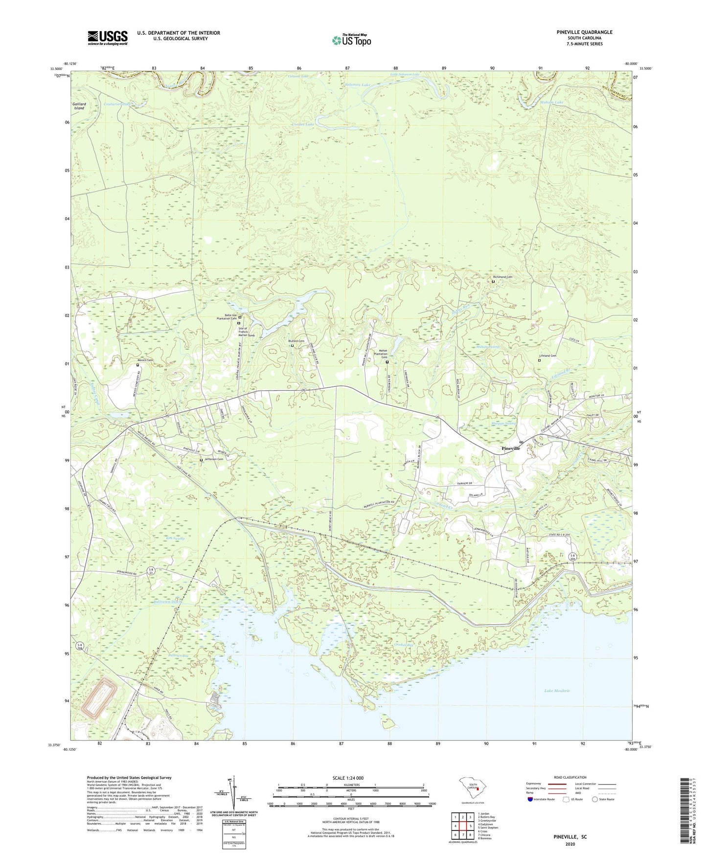
2024 topographic map quadrangle Pineville in the state of South Carolina. Scale: 1:24000. Based on the newly updated USGS 7.5' US Topo map series, this map is in the following counties: Berkeley, Williamsburg, Clarendon. The map contains contour data, water features, and other items you are used to seeing on USGS maps, but also has updated roads and other features. This is the next generation of topographic maps. Printed on high-quality waterproof paper with UV fade-resistant inks.
Quads adjacent to this one:
West: Eadytown
Northwest: Jordan
North: Butlers Bay
Northeast: Greeleyville
East: Saint Stephen
Southeast: Bonneau
South: Chicora
Southwest: Cross
This map covers the same area as the classic USGS quad with code o33080d1.
Contains the following named places: Belle Isle Chapel, Belle Isle Plantation, Belle Isle Plantation Cemetery, Bellisle School, Bluford Cemetery, Buckhall Bay, Bulltown Bay, Bulltown Ditch, Cahusac Lake, Cordes Lake, Couturier Lake, Crooked Bay, Cross School, Day Dawn Church, Dead River, Glen Camp Plantation, Green Hill School, Jefferson Cemetery, Jehovah Church, Johns Run, Judge Town, Kirk Swamp, Lifeland Cemetery, Maham Lake, Maham Swamp, Mahan Plantation Cemetery, Margate Swamp, Maude Cullen Health Center, Messiah Church, Mexico Cemetery, Mount Nebo Church, Murrell, Oakland Club, Palmer Chapel, Pilgrim Church, Pineville, Pineville Lookout Tower, Pineville Post Office, Prince Hill School, Redeemer Church, Redeemer School, Region Town, Richmond Cemetery, Saint Johns Church, Saint Peters Church, Saint Stephen Division, Santee Canal, Sinkler Dam, Site of Francis Marion Tomb, Smiths Chapel, Solomon Lake, South Carolina Noname 14004 D-3508 Dam, Tower Hill Plantation, Wing Road, Wood Lake, ZIP Code: 29468