MyTopo
Eadytown South Carolina US Topo Map
Couldn't load pickup availability
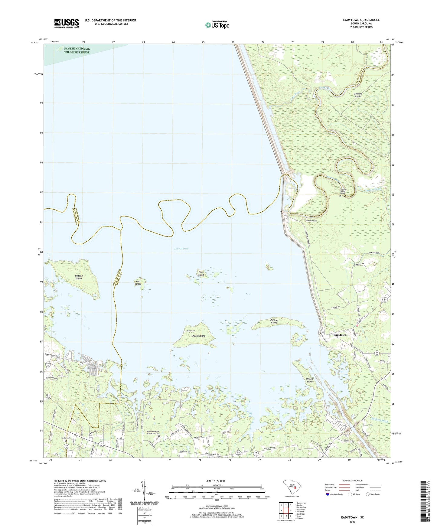
2024 topographic map quadrangle Eadytown in the state of South Carolina. Scale: 1:24000. Based on the newly updated USGS 7.5' US Topo map series, this map is in the following counties: Berkeley, Clarendon, Orangeburg. The map contains contour data, water features, and other items you are used to seeing on USGS maps, but also has updated roads and other features. This is the next generation of topographic maps. Printed on high-quality waterproof paper with UV fade-resistant inks.
Quads adjacent to this one:
West: Eutawville
Northwest: Summerton
North: Jordan
Northeast: Butlers Bay
East: Pineville
Southeast: Chicora
South: Cross
Southwest: Sandridge
This map covers the same area as the classic USGS quad with code o33080d2.
Contains the following named places: Bass Island, Bethel Church, Bethel School, Blackoak Island, Bluefield Cemetery, Cherry Grove Swamp, Chimney Island, Church Island, Corsada, Dead End Church, Eadytown, Eadytown Fire Department Company 13, Folly Pond School, Gaillard Island, Greenland Church, Greenland Swamp, Hickory Hill Church, Hickory Hill School, Irvin Lake, Little River, Moss Pond, Mount Pleasant Plantation Cemetery, Pine Grove Lake, Pine Island, Pintail Island, Richardson School, Rock Pond Campground, Rocks Cemetery, Rocks Church, Rocks Creek, Rocks Creek School, Saint Lukes Church, Saint Matthews Church, Santee Dam, Sixteen Island, South Carolina Noname 14016 Dam, Spring Plain, Springwood Swamp, Thomas Walter Grave, Unity Church, West Chapel, Wilsons Landing