MyTopo
Cash South Carolina US Topo Map
Couldn't load pickup availability
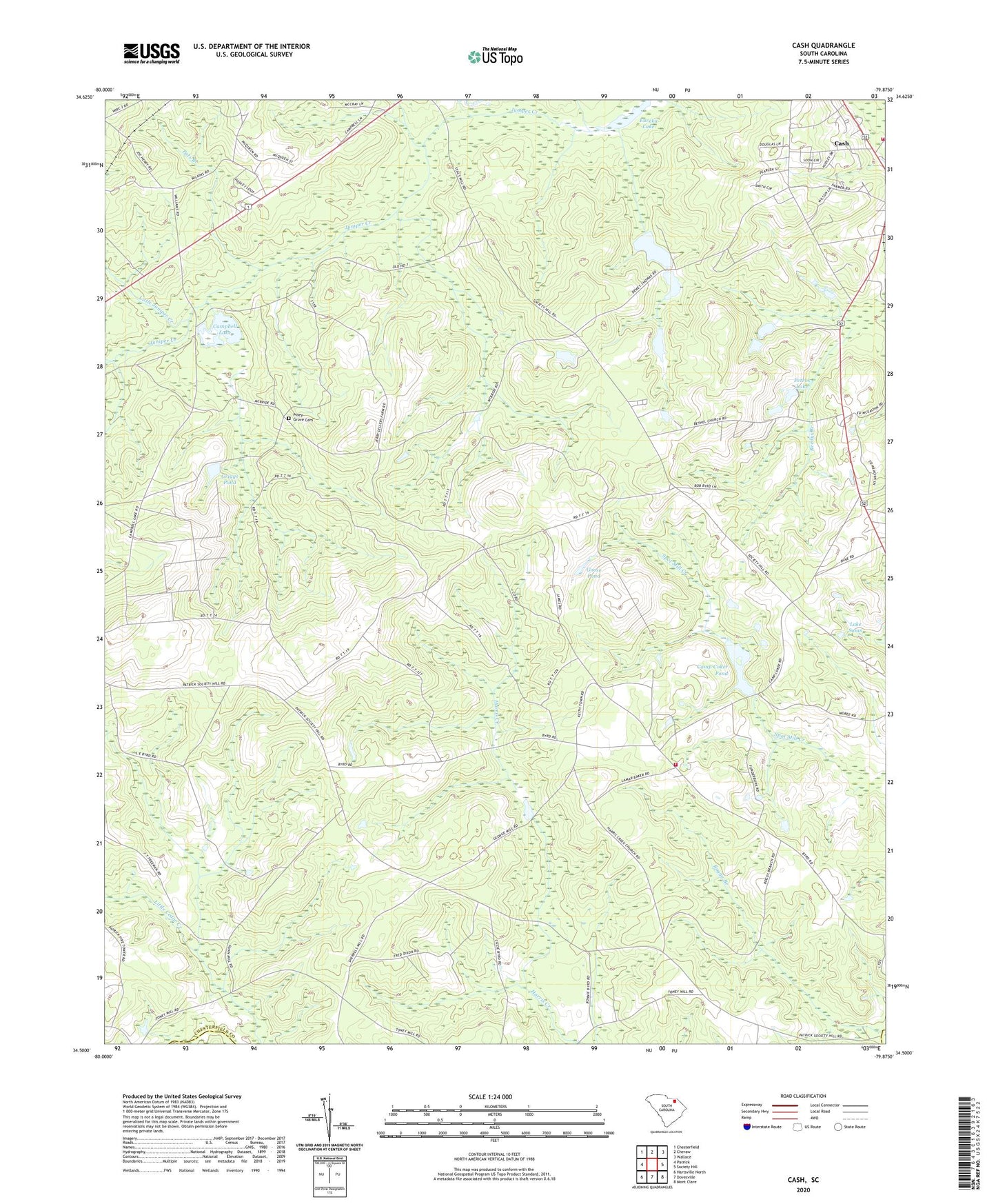
2024 topographic map quadrangle Cash in the state of South Carolina. Scale: 1:24000. Based on the newly updated USGS 7.5' US Topo map series, this map is in the following counties: Chesterfield, Darlington. The map contains contour data, water features, and other items you are used to seeing on USGS maps, but also has updated roads and other features. This is the next generation of topographic maps. Printed on high-quality waterproof paper with UV fade-resistant inks.
Quads adjacent to this one:
West: Patrick
Northwest: Chesterfield
North: Cheraw
Northeast: Wallace
East: Society Hill
Southeast: Mont Clare
South: Dovesville
Southwest: Hartsville North
This map covers the same area as the classic USGS quad with code o34079e8.
Contains the following named places: Bethel Church, Bethel Church Cemetery, Camp Coker, Camp Coker Pond, Campbell Lake, Campbell Mill, Cash, Cash Baptist Church, Cash Census Designated Place, Cash Fire Department, Development Dam D-2545, Edwards Chapel Baptist Church, Edwards Chapel Cemetery, Goose Pond, Griggs Pond, Griggs Pond Dam D-1869, Harris Creek Baptist Church, Harris Creek Church Cemetery, Harris Creek School, Harris Creek Volunteer Fire Department, Hendricks Pond Dam D-3230, Howle Pond Dam D-3231, Jim Rights Church, Lake Susan, Lake Susan Dam D-3234, Little Cedar Creek, Little Juniper Creek, Macedonia Baptist Church, Mcbride Pond Dam D-3229, McQueens Mill, Old Mount Olive Church, Patrick Lookout Tower, Pats Branch, Pats Branch School, Petros Lake, Petros Lake Dam D-3233, Piney Creek School, Piney Grove Cemetery, Piney Grove School, Prince Carr School, Rogers Pond Dam D-3232, Society Hill Church, South Carolina Noname 13008 D-3226 Dam, South Carolina Noname 13010 D-3225 Dam, Thomas Pond Dam D-1868, Wallace School, Willis Pond Dam D-1870, WJMX-FM (Cheraw), Youngs School