MyTopo
Patrick South Carolina US Topo Map
Couldn't load pickup availability
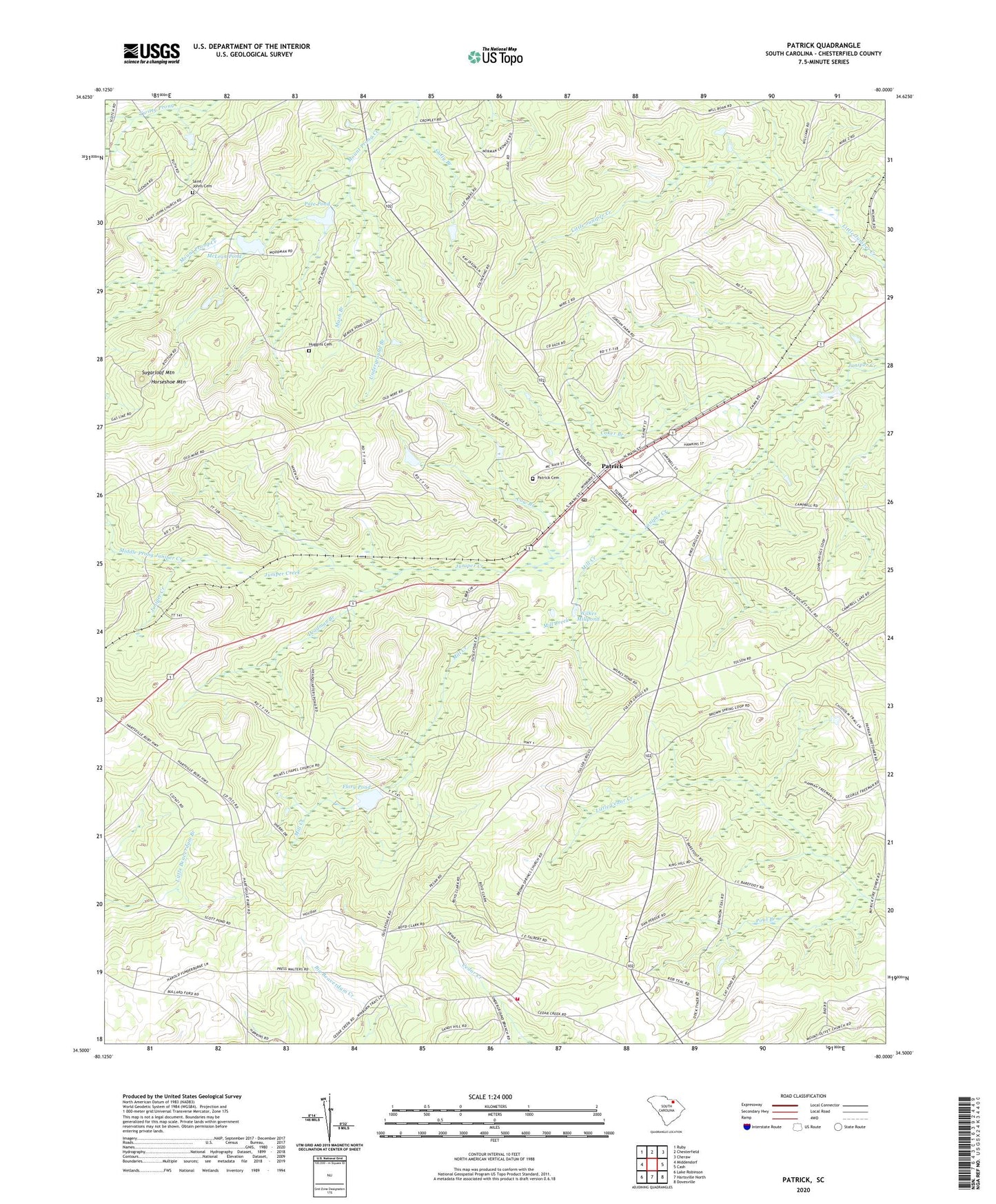
2024 topographic map quadrangle Patrick in the state of South Carolina. Scale: 1:24000. Based on the newly updated USGS 7.5' US Topo map series, this map is in the following counties: Chesterfield. The map contains contour data, water features, and other items you are used to seeing on USGS maps, but also has updated roads and other features. This is the next generation of topographic maps. Printed on high-quality waterproof paper with UV fade-resistant inks.
Quads adjacent to this one:
West: Middendorf
Northwest: Ruby
North: Chesterfield
Northeast: Cheraw
East: Cash
Southeast: Dovesville
South: Hartsville North
Southwest: Lake Robinson
This map covers the same area as the classic USGS quad with code o34080e1.
Contains the following named places: Alligator Fire Department Cedar Creek, Bear Creek Church, Bear Creek School, Brown Springs Baptist Church, Brown Springs Pond Dam D-3212, Cat Pond School, Cedar Creek Baptist Church, Church of God, Coker Branch, Cow Branch, Deadman Branch, Evans Mill, Flory Pond, Frances Chapel, Gully Branch, Horseshoe Mountain, Huggins Cemetery, Hunter Pond Dam D-3210, Juniper School, Lee Pond Dam D-3209, Mash Branch, McLean Pond, McLean Pond Dam D-3208, Middle Prong Juniper Creek, Mill Creek, Mount Olive Church, Ousley Dale Church, Ousley Dale Church Cemetery, Ousley Dale School, Ousleydale School, Palmetto School, Pate Pond, Patrick, Patrick Baptist Church, Patrick Cemetery, Patrick Church, Patrick Division, Patrick Fire Department, Patrick Rescue Squad, Plainview School, Pool Branch, Saint Johns Cemetery, Saint Johns Free Will Baptist Church, Sand Hills State Forest, Scott Pond Dam D-3213, South Carolina Noname 13059 D-3228 Dam, Spring Hill School, Sugarloaf Mountain, Town of Patrick, Underground Branch, Wilkes Chapel, Wilkes Millpond, Wilkes Millpond Dam D-3211, ZIP Code: 29584