MyTopo
Limestone South Carolina US Topo Map
Couldn't load pickup availability
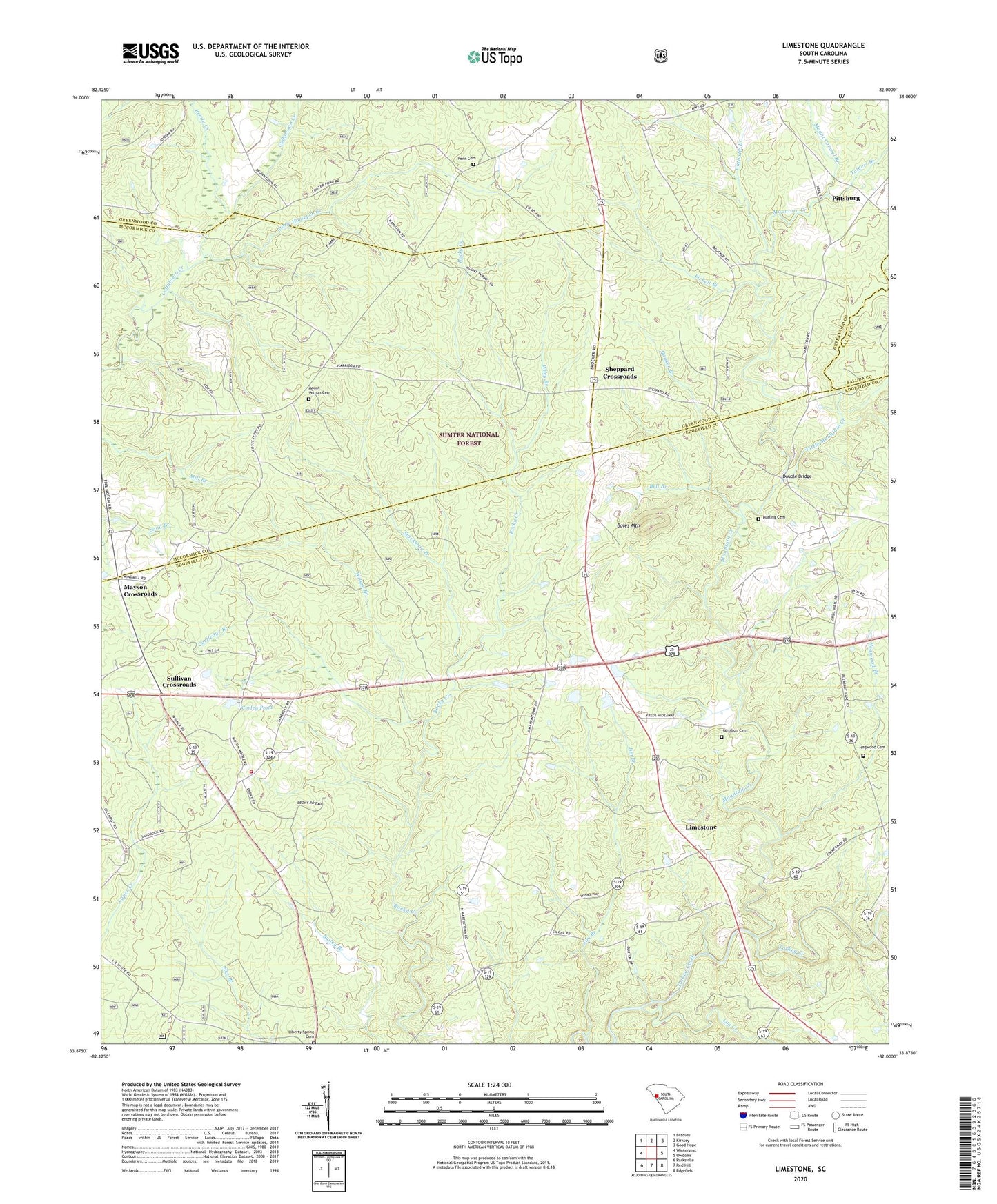
2020 topographic map quadrangle Limestone in the state of South Carolina. Scale: 1:24000. Based on the newly updated USGS 7.5' US Topo map series, this map is in the following counties: Edgefield, Greenwood, McCormick, Saluda. The map contains contour data, water features, and other items you are used to seeing on USGS maps, but also has updated roads and other features. This is the next generation of topographic maps. Printed on high-quality waterproof paper with UV fade-resistant inks.
Quads adjacent to this one:
West: Winterseat
Northwest: Bradley
North: Kirksey
Northeast: Good Hope
East: Owdoms
Southeast: Edgefield
South: Red Hill
Southwest: Parksville
Contains the following named places: Bailey Bethel Church, Bailey Bethel School, Bell Branch, Bold Spring Church, Boles Mountain, Cartledge Branch, Catholic Branch, Copper Spring School, Corley Pond, Cyper Creek Picnic Grounds, Double Bridge, Frost Hill School, Gilgal Church, Hamilton Cemetery, Harling Cemetery, Hegwood Branch, Hegwood Cemetery, Jim Branch, Liberty Spring Cemetery, Liberty Spring Church, Lime Stone, Limestone, Limestone Community Center, Limestone Farm, Limestone School, Little Horsepen Creek, Little Mountain Creek, Log Creek, Mayson Crossroads, Mount Carmel Branch, Mount Vernon Cemetery, Mount Vernon Church, Mountain Creek, Mountain Creek Church, Northside Fire Department Northside Substation, Outz Store, Penn Cemetery, Pickell Branch, Pittsburg, Pittsburg School, Pleasant Lane Church, Pleasant Lane Division, Pleasant Lane School, Quaker Branch, Reams Store, Reedy Creek, Sheppard Crossroads, Springfield Church, Springfield School, Stockman Branch, Sullivan Crossroads, Sullivan School, Talbert Branch, Wiley Branch, Wilson Branch, ZIP Code: 29848