
MyTopo
Middendorf South Carolina US Topo Map
Couldn't load pickup availability
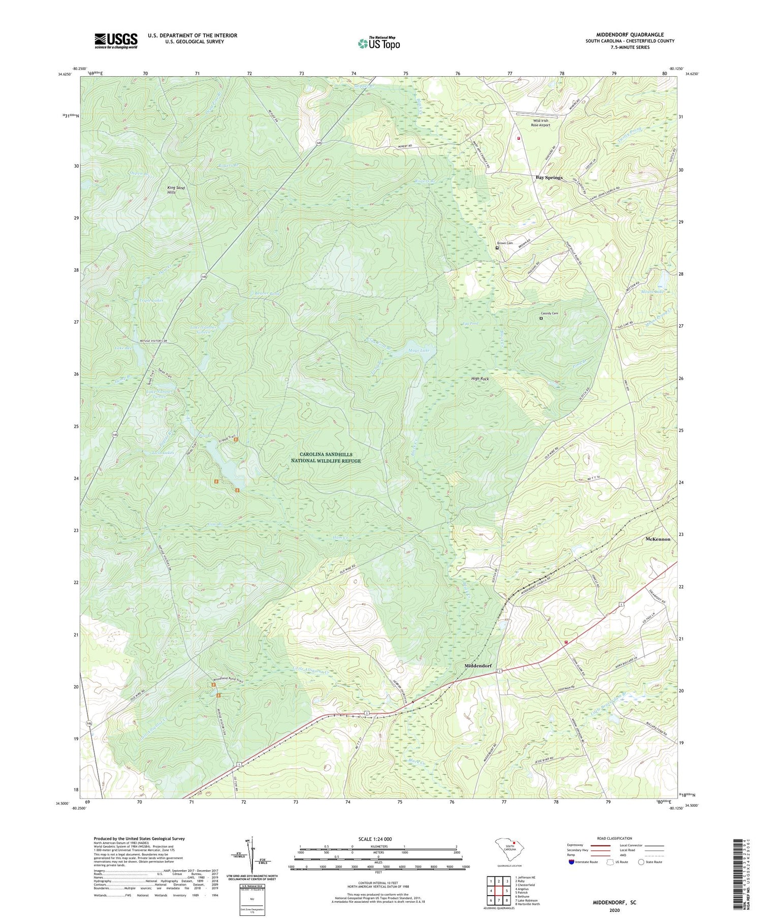
2020 topographic map quadrangle Middendorf in the state of South Carolina. Scale: 1:24000. Based on the newly updated USGS 7.5' US Topo map series, this map is in the following counties: Chesterfield. The map contains contour data, water features, and other items you are used to seeing on USGS maps, but also has updated roads and other features. This is the next generation of topographic maps. Printed on high-quality waterproof paper with UV fade-resistant inks.
Quads adjacent to this one:
West: Angelus
Northwest: Jefferson NE
North: Ruby
Northeast: Chesterfield
East: Patrick
Southeast: Hartsville North
South: Lake Robinson
Southwest: Bethune
Contains the following named places: Alligator Fire Department Middendorf, Bay Springs, Bay Springs Fire Department, Bay Springs School, Beaver Pond, Bethel Cemetery, Bethel Church, Bethlehem Church, Brown Cemetery, Carolina Sandhills National Wildlife Refuge, Cassidy Cemetery, Clay Ford Branch, Cow Branch, Egg Pond, Ham Creek, Hebron Church, Hemp Branch, High Rock, Johnsons Mill, King Sand Hills, Lake Bee, Lake Number 12 Dam D-3196, Lake Number 16 Dam D-3195, Lake Number Sixteen, Lake Number Twelve, Lightwood Log Branch, Little Alligator Creek, Long Branch, Martin Lake, Mays Lake, McBee Division, McKennon, Middendorf, Middendorf Baptist Church, Middendorf Pond Dam D-3199, Middendorf School, Morrison Pond Dam D-3214, Mount Lake, Mount Lake Dam D-1837, New Zion Baptist Church, Oxpen Lake Dam D-3193, Palmetto Baptist Church, Palmetto Church, Palmetto Church Cemetery, Pond Branch, Pool D, Pool G Dam D-1839, Poplar Branch, Rogers Branch, Ruby Lookout Tower, Skipper Creek, South Carolina Noname 13015 D-3198 Dam, South Carolina Noname 13018 D-3194 Dam, South Carolina Noname 13022 D-3197 Dam, South Carolina Noname 13023 D-3200 Dam, Sugarloaf Mountain Recreation Area, Thirty-seven Mile Siding, Triple Lakes, Twin Lakes, Wild Irish Rose Airport, Zion Hill School


