MyTopo
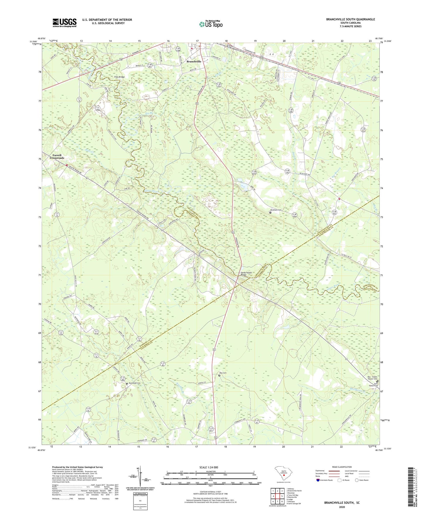
Branchville South South Carolina US Topo Map
Couldn't load pickup availability
2024 topographic map quadrangle Branchville South in the state of South Carolina. Scale: 1:24000. Based on the newly updated USGS 7.5' US Topo map series, this map is in the following counties: Orangeburg, Colleton, Bamberg, Dorchester. The map contains contour data, water features, and other items you are used to seeing on USGS maps, but also has updated roads and other features. This is the next generation of topographic maps. Printed on high-quality waterproof paper with UV fade-resistant inks.
Quads adjacent to this one:
West: Tony Hill Bay
Northwest: Midway
North: Branchville North
Northeast: Bowman
East: Reevesville
Southeast: Saint George SW
South: Williams
Southwest: Lodge
This map covers the same area as the classic USGS quad with code o33080b7.
Contains the following named places: Betty Branch, Branchville Fire Department, Branchville Fire Department McAlhany Station, Branchville High School, Branchville Police Department, Branchville Rescue Squad, Brier Creek, Buckhead Cemetery, Buckhead Church, Buckhead School, Bush Branch, Dukes Pond Dam D-3779, Edisto Baptist Church, Edisto Fire Department Station 9, Farrell Crossroads, Fifty Eight, Fitts Bridge, Hopewell School, Johnsville, Lockett Elementary School, Lovely Hill Church, Mack Branch Baptist Church, Mack Branch School, May - Stokes - Raysor Cemetery, May Cemetery, McAlbany Church, McAlhany Cemetery, McBranch Baptist Church, McIihenny School, Pen Branch, Piney Grove School, Sandy Island Bridge, Sandy Run Church, Sandy Run School, Simmons Johnsville School, Spell - Risher Cemetery, Whetstone Crossroads, ZIP Code: 29432