MyTopo
Branchville North South Carolina US Topo Map
Couldn't load pickup availability
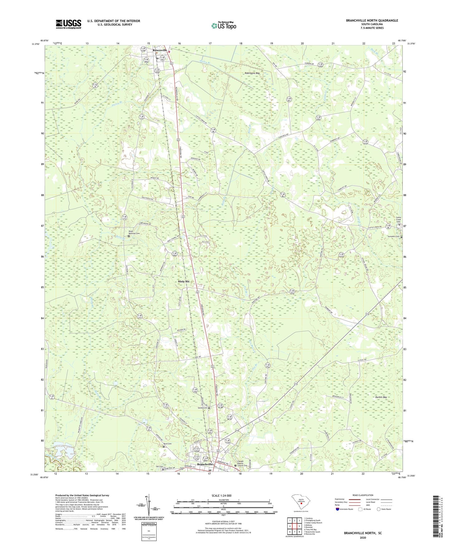
2024 topographic map quadrangle Branchville North in the state of South Carolina. Scale: 1:24000. Based on the newly updated USGS 7.5' US Topo map series, this map is in the following counties: Orangeburg, Bamberg. The map contains contour data, water features, and other items you are used to seeing on USGS maps, but also has updated roads and other features. This is the next generation of topographic maps. Printed on high-quality waterproof paper with UV fade-resistant inks.
Quads adjacent to this one:
West: Midway
Northwest: Cordova
North: Orangeburg South
Northeast: Indian Camp Branch
East: Bowman
Southeast: Reevesville
South: Branchville South
Southwest: Tony Hill Bay
This map covers the same area as the classic USGS quad with code o33080c7.
Contains the following named places: Bethel Church, Branchville, Branchville Baptist Church, Branchville Christian Church, Branchville Division, Branchville Elementary School, Branchville Post Office, Branchville United Methodist Church, Byrd Cemetery, Camp Edisto, Canaan Baptist Church Cemetery, Canaan Church, Cattle Creek Campground, Cattle Creek Cemetery, Cattle Creek Church, Cattle Creek Fire Department, Collier School, Duke School, Durbin Bay, East Branchville School, Mays Chapel, Mill Branch, Mill Branch School, Ott Cemetery, Peter Bowman Cemetery, Prospect Church, Prospect School, Robinsons Bay, Rowesville, Rowesville Fire Department, Rowesville Post Office, Rowesville School, Saint James Church, Saint James School, Saint Lukes Church, Saint Lukes School, Saint Stephens Church, Sardis Cemetery, Sardis Church, Sardis School, Sixty Six, Staley Branch, Summers Cemetery, Town of Branchville, Town of Rowesville, Wilson Chapel, ZIP Code: 29133