MyTopo
Sniders Crossroads South Carolina US Topo Map
Couldn't load pickup availability
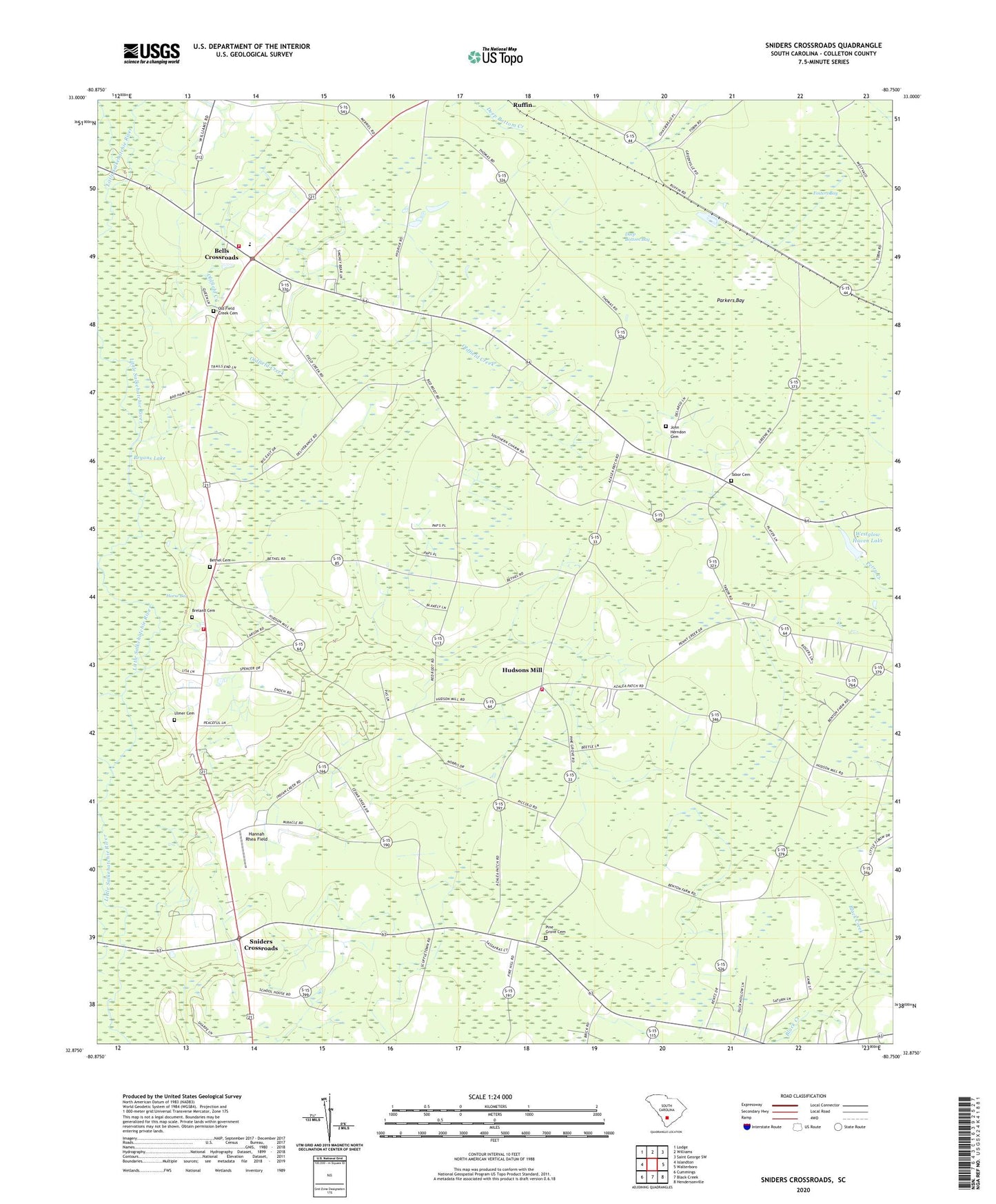
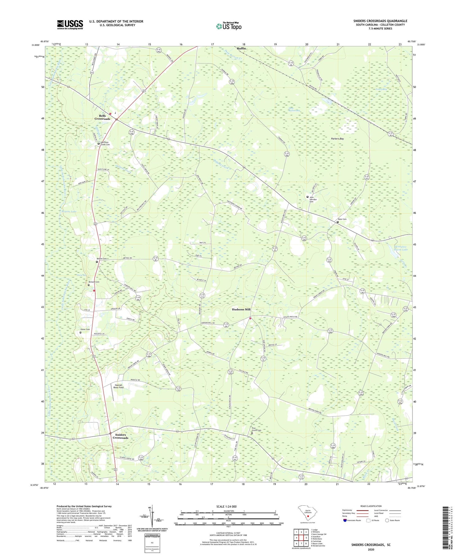
2020 topographic map quadrangle Sniders Crossroads in the state of South Carolina. Scale: 1:24000. Based on the newly updated USGS 7.5' US Topo map series, this map is in the following counties: Colleton. The map contains contour data, water features, and other items you are used to seeing on USGS maps, but also has updated roads and other features. This is the next generation of topographic maps. Printed on high-quality waterproof paper with UV fade-resistant inks.
Quads adjacent to this one:
West: Islandton
Northwest: Lodge
North: Williams
Northeast: Saint George SW
East: Walterboro
Southeast: Hendersonville
South: Black Creek
Southwest: Cummings
Contains the following named places: Bells Crossroads, Bells Elementary School, Benton Mill School, Benton's Mill School, Bethel Cemetery, Bethel School, Bethel United Methodist Church, Breland Cemetery, Bryans Lake, Buckhead Creek, Colleton Fire Department Station 18, Colleton Fire Department Station 31, Colleton Fire Department Station 4, Deep Bottom Bay, Fosters Bay, Hannah Rhea Field, Hudson Mill Pond, Hudson Mill School, Hudsons Mill, Indian Creek, Indian Creek Church, John Herndon Cemetery, Little Rock School, Old Field Creek Cemetery, Oldfield Creek, Omega School, Parkers Bay, Pattillo, Pine Grove Cemetery, Pine Grove Number 1 Baptist Church, Red Root School, Sniders Crossroads, Sniders School, Sykes Savannah Church, Tabor Cemetery, Tabor Methodist Church, Tabor School, Ulmer Cemetery, Westglow Haven Lake, Westglow Haven Lake Dam D-2389, Zion Church, ZIP Code: 29475