MyTopo
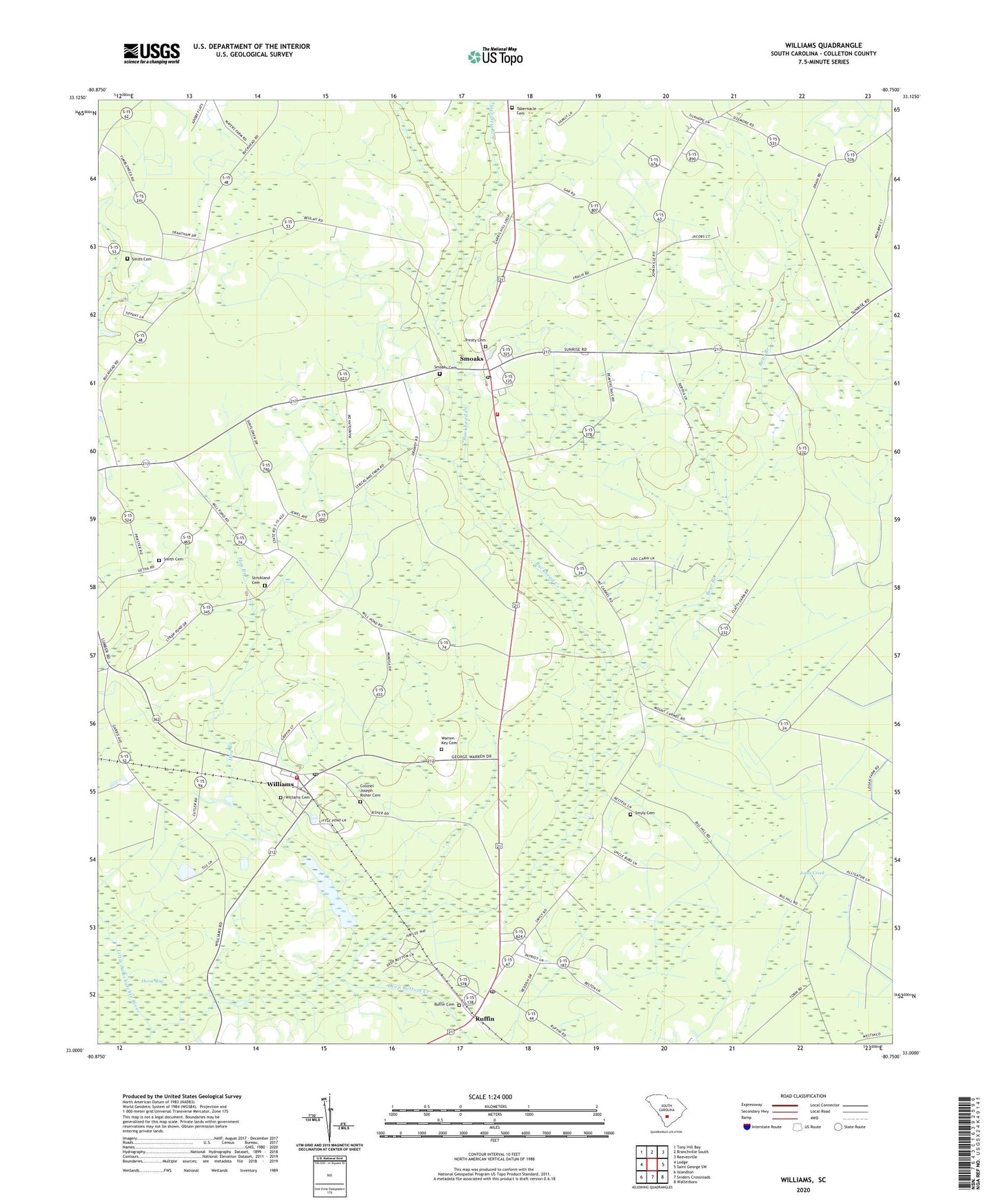
Williams South Carolina US Topo Map
Couldn't load pickup availability
2024 topographic map quadrangle Williams in the state of South Carolina. Scale: 1:24000. Based on the newly updated USGS 7.5' US Topo map series, this map is in the following counties: Colleton. The map contains contour data, water features, and other items you are used to seeing on USGS maps, but also has updated roads and other features. This is the next generation of topographic maps. Printed on high-quality waterproof paper with UV fade-resistant inks.
Quads adjacent to this one:
West: Lodge
Northwest: Tony Hill Bay
North: Branchville South
Northeast: Reevesville
East: Saint George SW
Southeast: Walterboro
South: Sniders Crossroads
Southwest: Islandton
This map covers the same area as the classic USGS quad with code o33080a7.
Contains the following named places: Bear Branch, Bethel Church, Bethel School, Beulah Church, Church of God, Colleton Fire Department Station 16, Colleton Fire Department Station 7, Colonel Joseph Risher Cemetery, Deep Bottom Creek, Fenders Mill Pond, Hog Branch, Hunters Chapel, J J Padgett Pond, Jones Creek, Mount Olive Church, Ruffin, Ruffin Baptist Church, Ruffin Cemetery, Ruffin Church, Ruffin High School, Ruffin Middle School, Ruffin Post Office, Smith Cemetery, Smoaks, Smoaks Baptist Church, Smoaks Cemetery, Smoaks Division, Smoaks Middle School, Smoaks Post Office, Smyly, Smyly Cemetery, South Carolina Noname 15028 D-2383 Dam, Steedley Branch, Strickland Cemetery, Strickland School, Tabernacle Cemetery, Tabernacle Church, Town of Smoaks, Town of Williams, Trinity Cemetery, Trinity Methodist Church, Warren - Key Cemetery, Williams, Williams Cemetery, Williams Post Office, ZIP Codes: 29481, 29493