MyTopo
Tony Hill Bay South Carolina US Topo Map
Couldn't load pickup availability
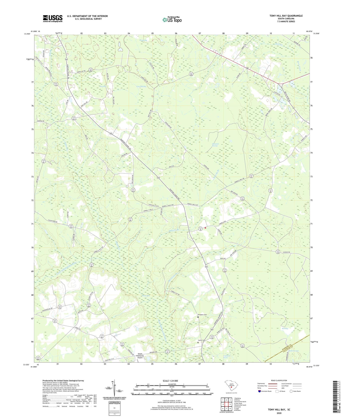
2020 topographic map quadrangle Tony Hill Bay in the state of South Carolina. Scale: 1:24000. Based on the newly updated USGS 7.5' US Topo map series, this map is in the following counties: Bamberg, Colleton. The map contains contour data, water features, and other items you are used to seeing on USGS maps, but also has updated roads and other features. This is the next generation of topographic maps. Printed on high-quality waterproof paper with UV fade-resistant inks.
Quads adjacent to this one:
West: Clear Pond
Northwest: Bamberg
North: Midway
Northeast: Branchville North
East: Branchville South
Southeast: Williams
South: Lodge
Southwest: Ehrhardt
Contains the following named places: Bamberg Division, Bethel Church, Bull Bay, Butlers Pond Dam D-2824, Camp Branch School, Carter Cemetery, Claflin Church, Claflin School, Colt Branch, Cowpen Ford, Crooked Pond, Drawdy Branch, Edisto School, Fish Pond, Fish Pond Church, Free Gift Baptist Church, Gethsemane Baptist Church, Goodland Baptist Church, Hog Bay, Hunters Chapel Baptist Church, Hunters Chapel Fire Department, Hunters Chapel School, Hurricane Branch, Lemon Creek, Little Swamp, Millersville, Oak Grove School, Pine Grove School, Piney Bay, Piney Grove Church, Poplar Grove School, Prospect Cemetery, Prospect Church, Schofield Swamp, Shiloh Plantation Airport, Tony Hill Bay, Truevine Church, Woodlawn Cemetery, Woodlawn School, Zion Church