MyTopo
Belle Fourche South Dakota US Topo Map
Couldn't load pickup availability
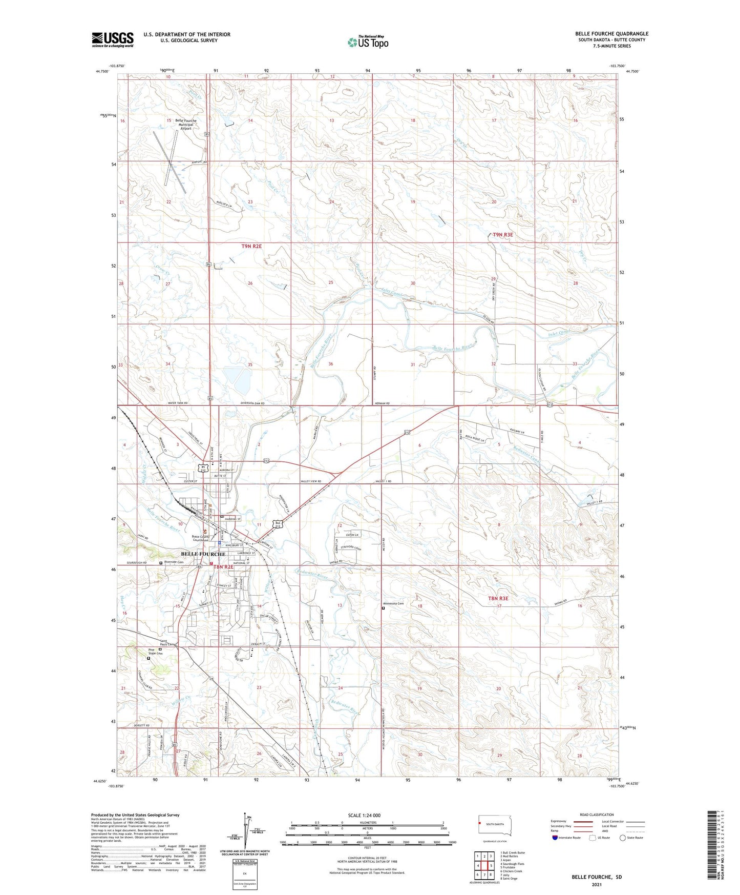
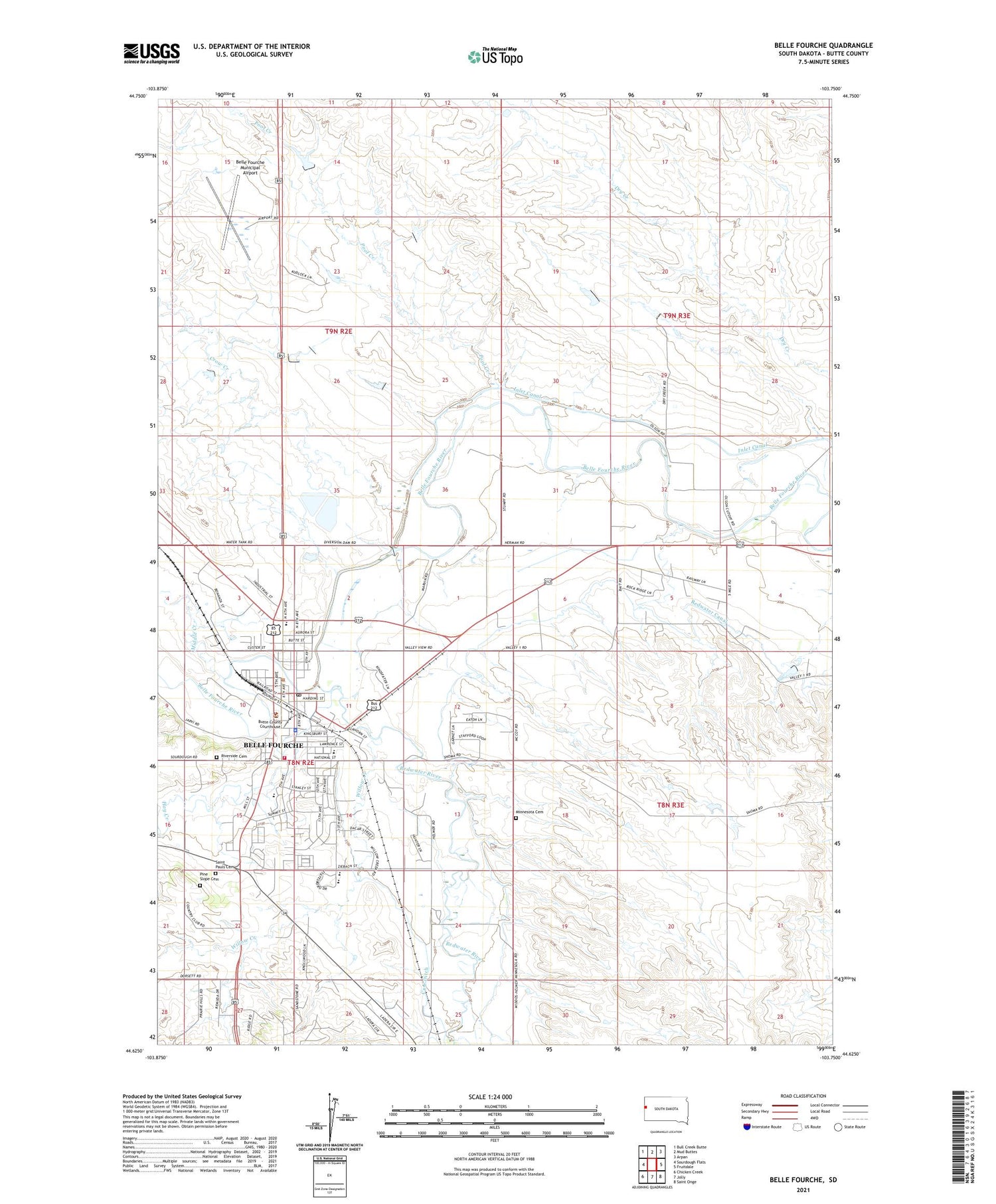
2021 topographic map quadrangle Belle Fourche in the state of South Dakota. Scale: 1:24000. Based on the newly updated USGS 7.5' US Topo map series, this map is in the following counties: Butte. The map contains contour data, water features, and other items you are used to seeing on USGS maps, but also has updated roads and other features. This is the next generation of topographic maps. Printed on high-quality waterproof paper with UV fade-resistant inks.
Quads adjacent to this one:
West: Sourdough Flats
Northwest: Bull Creek Butte
North: Mud Buttes
Northeast: Arpan
East: Fruitdale
Southeast: Saint Onge
South: Jolly
Southwest: Chicken Creek
Contains the following named places: Belle Fourche, Belle Fourche Area Community Center, Belle Fourche City Hall, Belle Fourche Diversion Dam, Belle Fourche High School, Belle Fourche Middle School, Belle Fourche Municipal Airport, Belle Fourche Police Department, Belle Fourche Post Office, Belle Fourche Public Library, Belle Fourche Volunteer Fire Department, Bus Field, Butte County Ambulance Service Belle, Butte County Courthouse, Butte County Sheriff's Office, Case Ditch, City of Belle Fourche, Crow Creek, Hay Creek, Ingersol School, Inlet Canal, KBFS-AM (Belle Fourche), Middle Creek, Minnesota Cemetery, North Park Elementary School, Pine Slope Cemetery, Pool Creek, Redwater Canal, Redwater River, Riverside Cemetery, Saint Pauls Cemetery, South Park Elementary School, Township of Minnesela, Tri-State Museum, Willow Creek