MyTopo
Saint Onge South Dakota US Topo Map
Couldn't load pickup availability
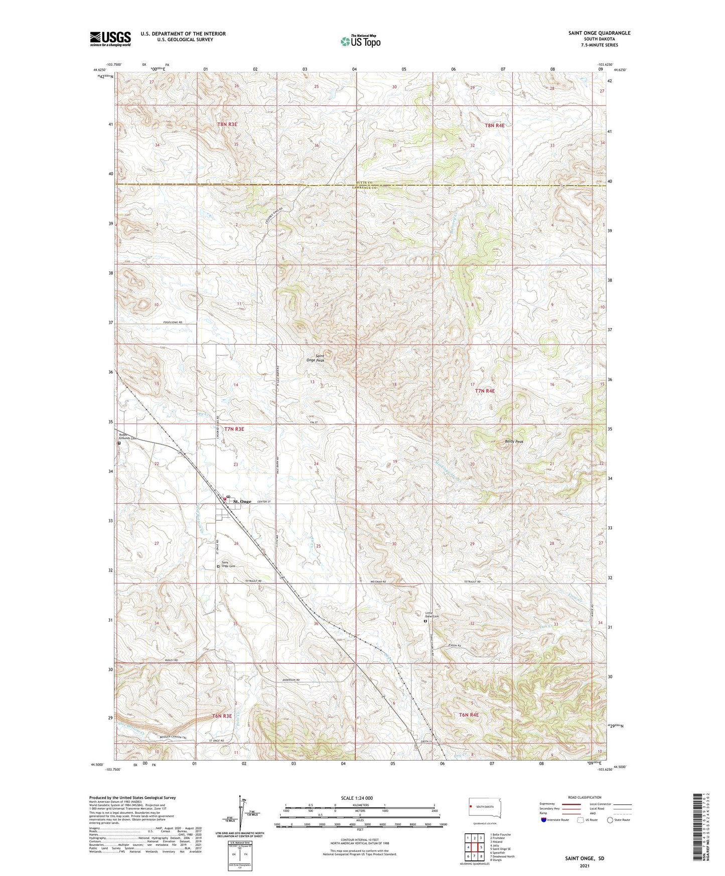
2021 topographic map quadrangle Saint Onge in the state of South Dakota. Scale: 1:24000. Based on the newly updated USGS 7.5' US Topo map series, this map is in the following counties: Lawrence, Butte. The map contains contour data, water features, and other items you are used to seeing on USGS maps, but also has updated roads and other features. This is the next generation of topographic maps. Printed on high-quality waterproof paper with UV fade-resistant inks.
Quads adjacent to this one:
West: Jolly
Northwest: Belle Fourche
North: Fruitdale
Northeast: Nisland
East: Saint Onge SE
Southeast: Sturgis
South: Deadwood North
Southwest: Spearfish
This map covers the same area as the classic USGS quad with code o44103e6.
Contains the following named places: Asbury School, Baldy Peak, Dane Church, Dry Creek, Little Dane Cemetery, Middle False Bottom School, Polo Creek, Rodeo Grounds Cemetery, Saint Onge, Saint Onge Cemetery, Saint Onge Census Designated Place, Saint Onge Peak, Saint Onge Post Office, Saint Onge Volunteer Fire Department, Township of Saint Onge