
MyTopo
Blackhawk South Dakota US Topo Map
Couldn't load pickup availability
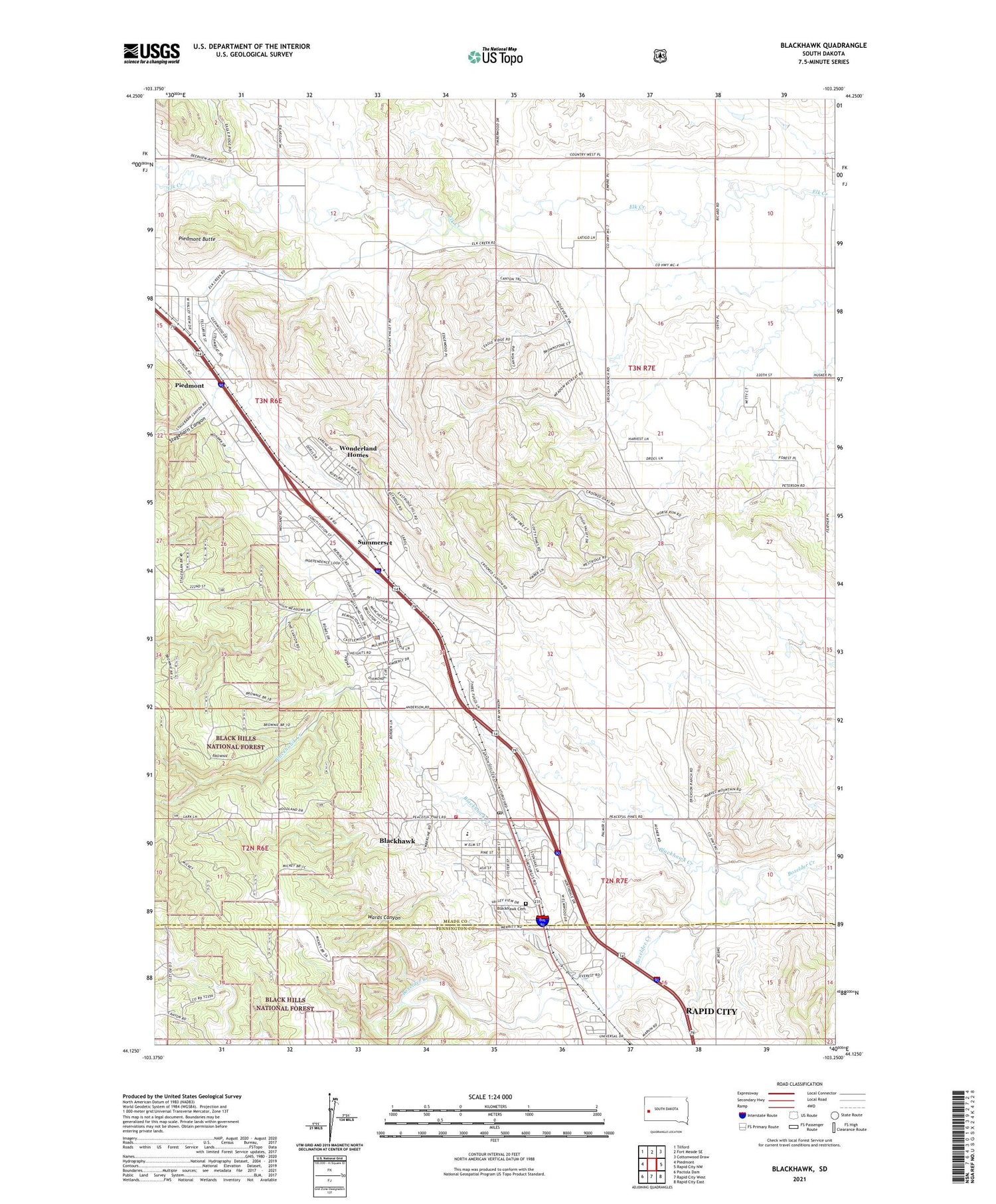
2021 topographic map quadrangle Blackhawk in the state of South Dakota. Scale: 1:24000. Based on the newly updated USGS 7.5' US Topo map series, this map is in the following counties: Meade, Pennington. The map contains contour data, water features, and other items you are used to seeing on USGS maps, but also has updated roads and other features. This is the next generation of topographic maps. Printed on high-quality waterproof paper with UV fade-resistant inks.
Quads adjacent to this one:
West: Piedmont
Northwest: Tilford
North: Fort Meade SE
Northeast: Cottonwood Draw
East: Rapid City NW
Southeast: Rapid City East
South: Rapid City West
Southwest: Pactola Dam
Contains the following named places: Benoit School, Black Hawk Elementary School, Black Hawk Fire Department, Black Hawk Post Office, Black Hills Kennel Club, Blackhawk, Blackhawk Cemetery, Blackhawk Census Designated Place, Blackhawk Creek, City of Piedmont, City of Summerset, Evergreen School, Holmes School, Piedmont Butte, Piedmont Volunteer Fire Department Substation, Sidney Stockdale, Stagebarn Canyon, Summerset, Summerset City Hall, Summerset Police Department, Wards Canyon, Wonderland Homes, Wonderland Homes Census Designated Place, ZIP Codes: 57718, 57769


