MyTopo
Piedmont South Dakota US Topo Map
Couldn't load pickup availability
Also explore the Piedmont Forest Service Topo of this same quad for updated USFS data
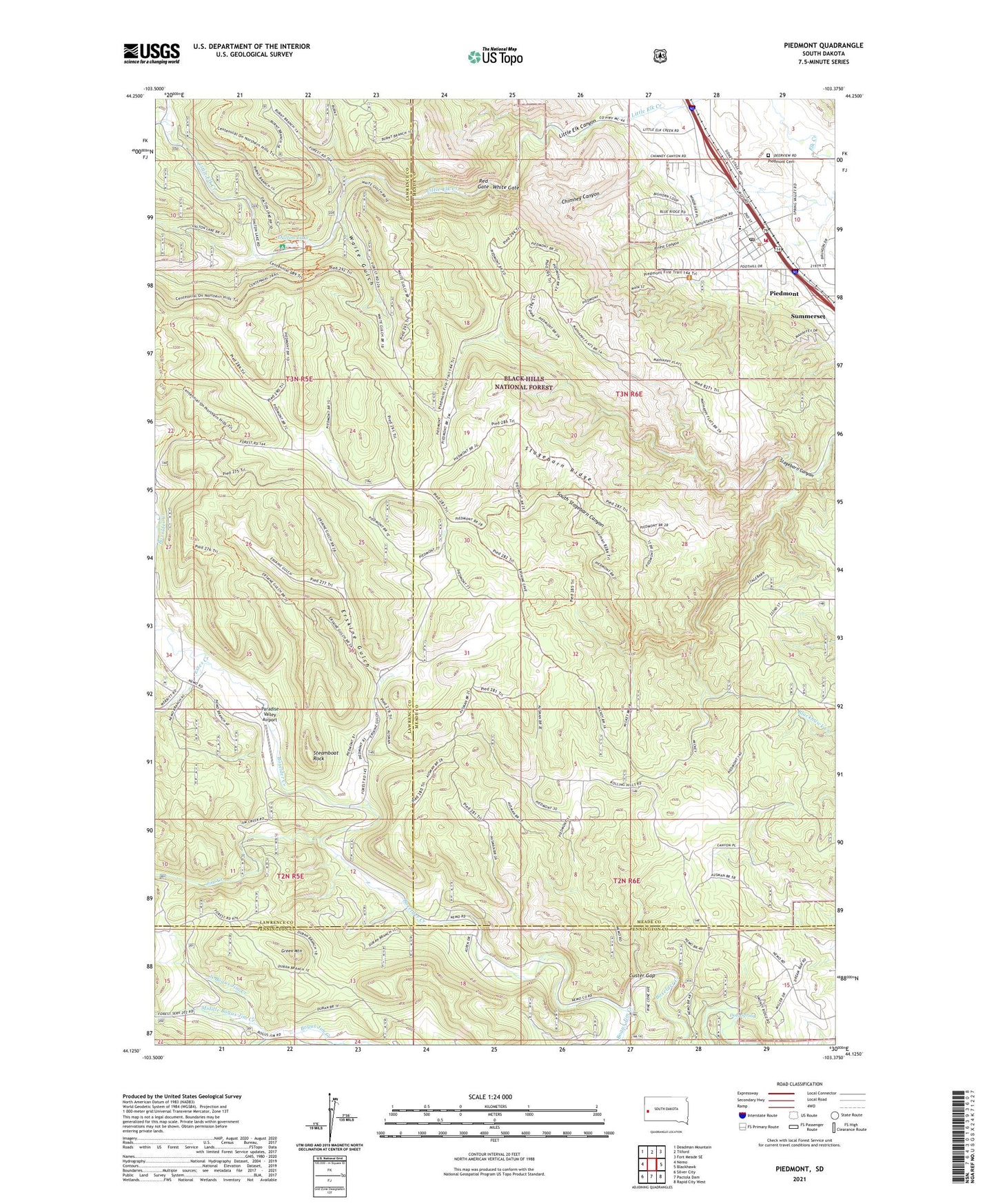
2021 topographic map quadrangle Piedmont in the state of South Dakota. Scale: 1:24000. Based on the newly updated USGS 7.5' US Topo map series, this map is in the following counties: Meade, Lawrence, Pennington. The map contains contour data, water features, and other items you are used to seeing on USGS maps, but also has updated roads and other features. This is the next generation of topographic maps. Printed on high-quality waterproof paper with UV fade-resistant inks.
Quads adjacent to this one:
West: Nemo
Northwest: Deadman Mountain
North: Tilford
Northeast: Fort Meade SE
East: Blackhawk
Southeast: Rapid City West
South: Pactola Dam
Southwest: Silver City
This map covers the same area as the classic USGS quad with code o44103b4.
Contains the following named places: Camp Columbus, Camp Este, Carwye, Chimney Canyon, Custer Gap, Dalton Campground, Dalton Lake, Doty Spring, Erskine Gulch, Estes, Estes Creek, Goiens, Green Mountain, Jim Creek, Little Elk Canyon, Middle Bogus Jim Creek, North Bogus Jim Creek, Paradise Valley Airport, Piedmont, Piedmont Cemetery, Piedmont City Hall, Piedmont Post Office, Piedmont Public Library, Piedmont Valley Elementary School, Piedmont Volunteer Fire Department, Pinkerton School, Priest Canyon, Red Gate, South Stagebarn Canyon, Stage Barn, Stagebarn Ridge, Steamboat Rock, Streamboat Rock Picnic Area, Waite Gulch, White Gate