MyTopo
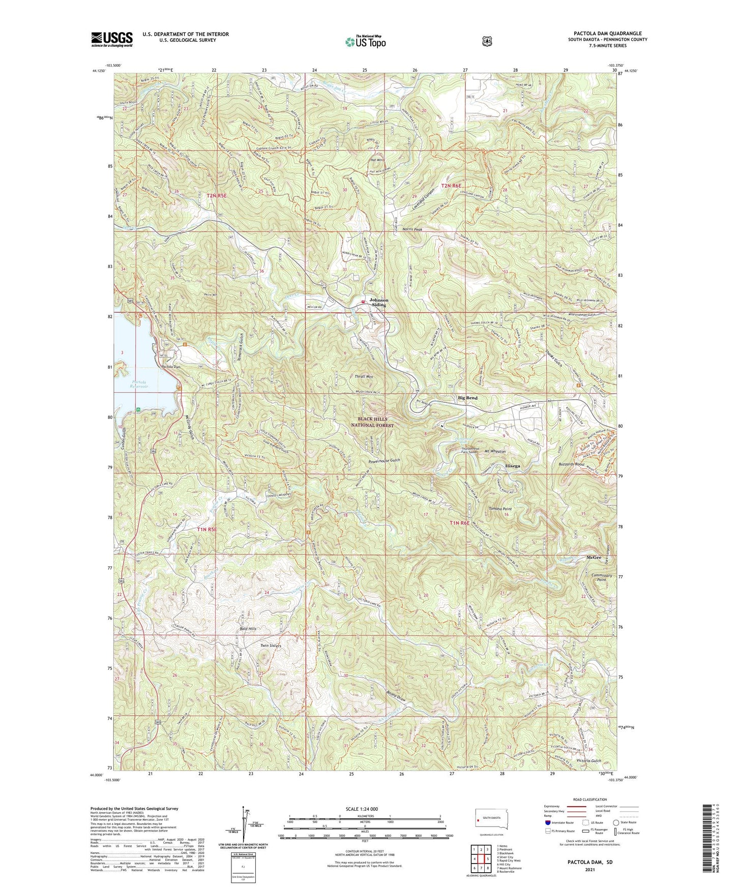
Pactola Dam South Dakota US Topo Map
Couldn't load pickup availability
Also explore the Pactola Dam Forest Service Topo of this same quad for updated USFS data
2021 topographic map quadrangle Pactola Dam in the state of South Dakota. Scale: 1:24000. Based on the newly updated USGS 7.5' US Topo map series, this map is in the following counties: Pennington. The map contains contour data, water features, and other items you are used to seeing on USGS maps, but also has updated roads and other features. This is the next generation of topographic maps. Printed on high-quality waterproof paper with UV fade-resistant inks.
Quads adjacent to this one:
West: Silver City
Northwest: Nemo
North: Piedmont
Northeast: Blackhawk
East: Rapid City West
Southeast: Rockerville
South: Mount Rushmore
Southwest: Hill City
This map covers the same area as the classic USGS quad with code o44103a4.
Contains the following named places: Bald Hills, Big Bend, Bogus Jim Creek, Boone Draw, Brush Creek, Buzzards Roost, Commissary Point, Custer Gulch, Deer Creek, Gold Standard Gulch, Hat Mountain, Hisega, Hisega Post Office, Johnson Siding, Johnson Siding Census Designated Place, Johnson Siding Volunteer Fire Department Station 1, Loveland Canyon, McCurdy Gulch, McGee, Moose Camp, Mount Wheaton, Norris Peak, Pactola, Pactola Dam, Pactola Forest Service Facility, Pactola Point Picnic Area, Pactola Visitor Center, Perrin Mountain, Placerville Camp, Power House, Powerhouse Gulch, Prairie Creek, Presbyterian Church Camp, Rimrock Community Center, Shanks Gulch, South Bogus Jim Creek, South Branch Prairie Creek, South Victoria Creek, Tamarack Gulch, Thrall Mountain, Thunderbird Homes Addition, Thunderhead Falls, Thunderhead Falls Tunnel, Tomaha Camp, Tomaha Point, Township of Pactola, Twin Sisters, Victoria Dam, Wheaton College Summer Camp, ZIP Code: 57702