MyTopo
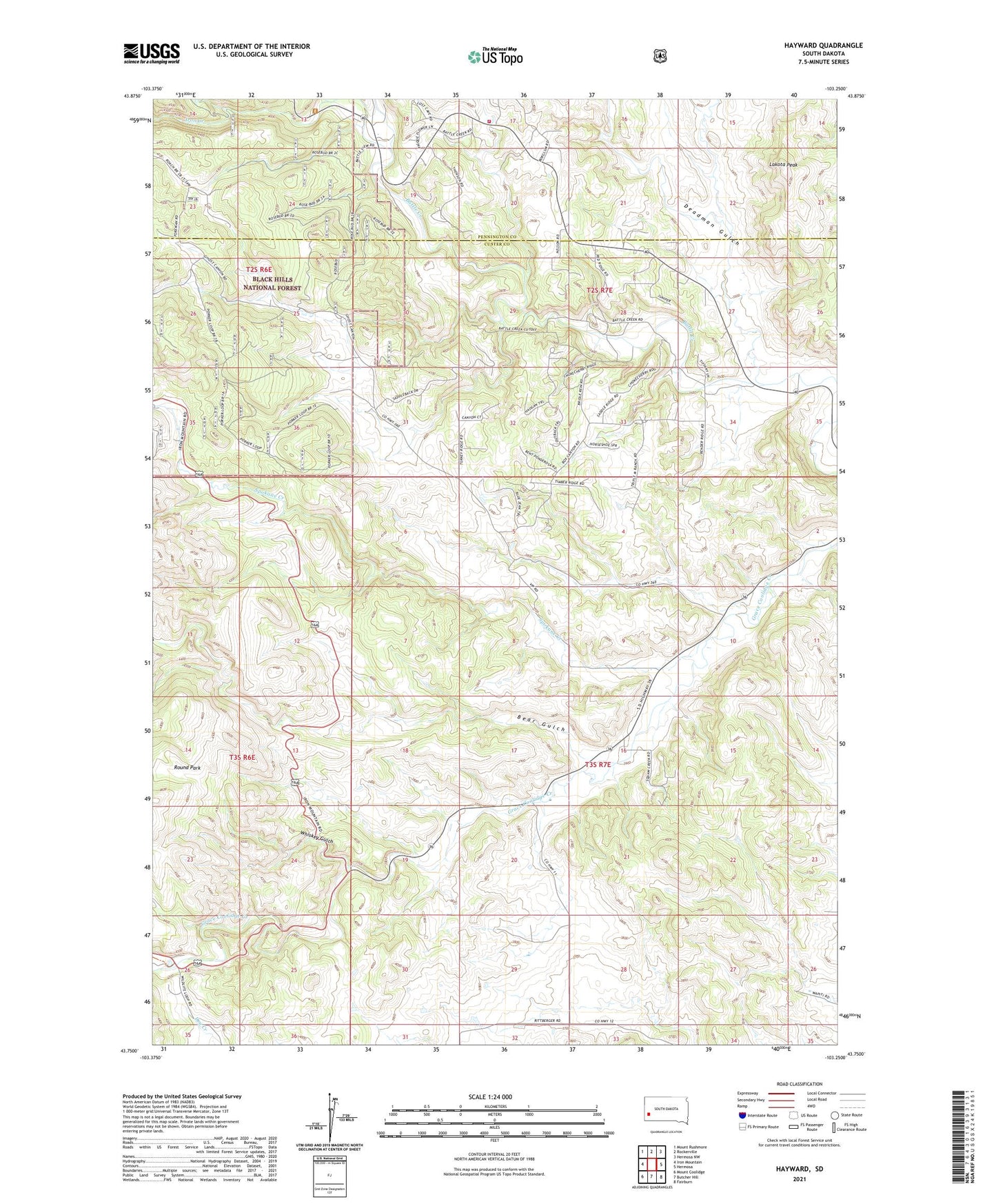
Hayward South Dakota US Topo Map
Couldn't load pickup availability
Also explore the Hayward Forest Service Topo of this same quad for updated USFS data
2023 topographic map quadrangle Hayward in the state of South Dakota. Scale: 1:24000. Based on the newly updated USGS 7.5' US Topo map series, this map is in the following counties: Custer, Pennington. The map contains contour data, water features, and other items you are used to seeing on USGS maps, but also has updated roads and other features. This is the next generation of topographic maps. Printed on high-quality waterproof paper with UV fade-resistant inks.
Quads adjacent to this one:
West: Iron Mountain
Northwest: Mount Rushmore
North: Rockerville
Northeast: Hermosa NW
East: Hermosa
Southeast: Fairburn
South: Butcher Hill
Southwest: Mount Coolidge
This map covers the same area as the classic USGS quad with code o43103g3.
Contains the following named places: Bear Gulch, Central School, Deadman Gulch, Hayward, Hayward Fire Department, Iron Creek, Lakota Peak, Maderposson Mine, Rosebud Mine, Round Park, Spokane Creek, Star Lode Mine, Whiskey Gulch, Wood Tin Mine