MyTopo
Rockerville South Dakota US Topo Map
Couldn't load pickup availability
Also explore the Rockerville Forest Service Topo of this same quad for updated USFS data
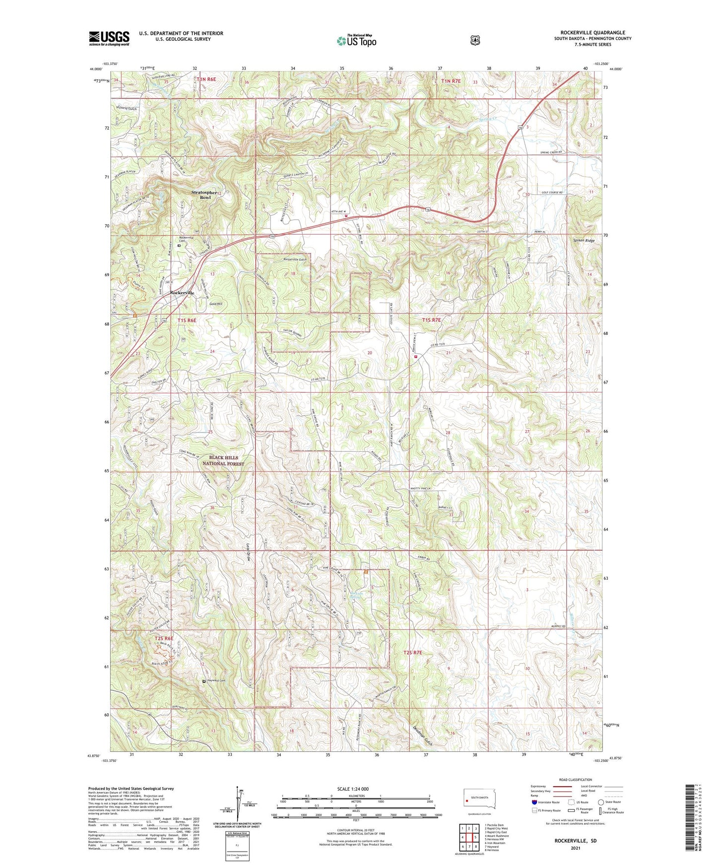
2021 topographic map quadrangle Rockerville in the state of South Dakota. Scale: 1:24000. Based on the newly updated USGS 7.5' US Topo map series, this map is in the following counties: Pennington. The map contains contour data, water features, and other items you are used to seeing on USGS maps, but also has updated roads and other features. This is the next generation of topographic maps. Printed on high-quality waterproof paper with UV fade-resistant inks.
Quads adjacent to this one:
West: Mount Rushmore
Northwest: Pactola Dam
North: Rapid City West
Northeast: Rapid City East
East: Hermosa NW
Southeast: Hermosa
South: Hayward
Southwest: Iron Mountain
This map covers the same area as the classic USGS quad with code o43103h3.
Contains the following named places: Beermug Dam, Blair School, Deadman Creek, Ferguson Mine, Foster Gulch, Four Ranch, Giltedge Mine, Gold Hill, Hayward Cemetery, Jackson Spring, Lead Draw, Mica Mine, Pine Grove School, Ponca Group Mine, Rattlesnake Mine, Rockerville, Rockerville Airport, Rockerville Cemetery, Rockerville Gulch, Rockerville Post Office, Rockerville Volunteer Fire Department Station 1, Strato Rim Overlook Campground, Stratosphere Bowl, Tiger Lode Mine, Unorganized Territory of Central Pennington, Victoria Gulch