MyTopo
Kingsburg South Dakota US Topo Map
Couldn't load pickup availability
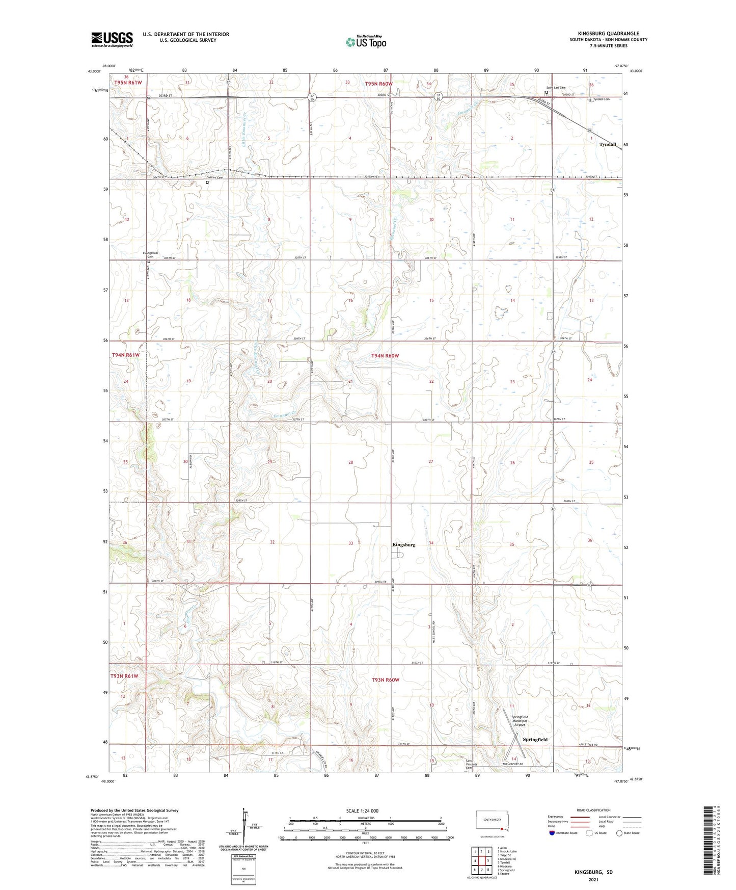
2021 topographic map quadrangle Kingsburg in the state of South Dakota. Scale: 1:24000. Based on the newly updated USGS 7.5' US Topo map series, this map is in the following counties: Bon Homme. The map contains contour data, water features, and other items you are used to seeing on USGS maps, but also has updated roads and other features. This is the next generation of topographic maps. Printed on high-quality waterproof paper with UV fade-resistant inks.
Quads adjacent to this one:
West: Niobrara NE
Northwest: Avon
North: Haucks Lake
Northeast: Tripp SE
East: Tyndall
Southeast: Santee
South: Springfield
Contains the following named places: Albion School, Bon Homme County, Evan Church, Evangelical Cemetery, Kingsburg, Little Emanuel Creek, North Bon Homme State Public Shooting Area, Saint Leo Cemetery, Sattler Cemetery, School Number 31, School Number 32, School Number 33, School Number 34, School Number 60, School Number 75, School Number 76, School Number 77, South Bon Homme State Public Shooting Area, Springfield Municipal Airport, Township of Albion, Township of Springfield, Tyndall Cemetery, Unorganized Territory of Southwest Bon Homme