MyTopo
Tripp SE South Dakota US Topo Map
Couldn't load pickup availability
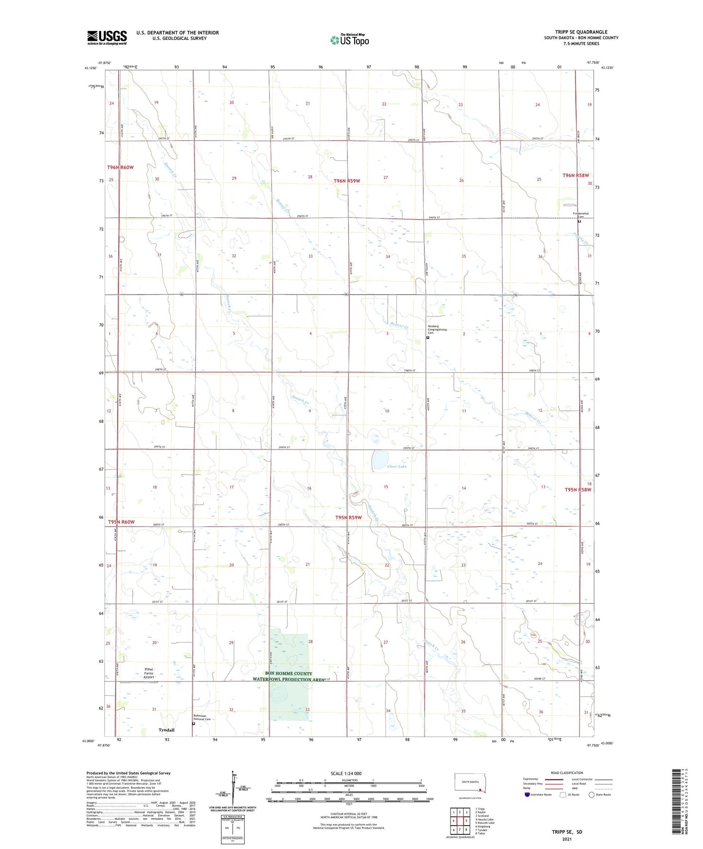
2021 topographic map quadrangle Tripp SE in the state of South Dakota. Scale: 1:24000. Based on the newly updated USGS 7.5' US Topo map series, this map is in the following counties: Bon Homme. The map contains contour data, water features, and other items you are used to seeing on USGS maps, but also has updated roads and other features. This is the next generation of topographic maps. Printed on high-quality waterproof paper with UV fade-resistant inks.
Quads adjacent to this one:
West: Haucks Lake
Northwest: Tripp
North: Kaylor
Northeast: Scotland
East: Kloucek Lake
Southeast: Tabor
South: Tyndall
Southwest: Kingsburg
This map covers the same area as the classic USGS quad with code o43097a7.
Contains the following named places: Blaha, Blaha Post Office, Blaha School, Bohemian National Cemetery, Bon Homme County Waterfowl Production Area, Clear Lake, Freidensthal Cemetery, Lutheran Church, Nedved School, Neuberg Congregational Cemetery, Plihal Farms Airport, School Number 12, School Number 13, School Number 18, School Number 19, School Number 22, School Number 47, Township of Jackson, Township of Scotland, Unorganized Territory of Northeast Bon Homme, ZIP Code: 57059